Area Overview for Llancarfan Community
Photos of Llancarfan Community


Area Information
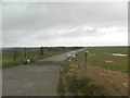
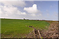
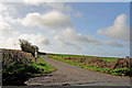
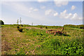
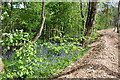
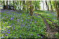
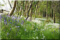
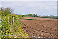
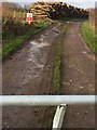
Llancarfan Community stands as a distinct civil parish nestled on a gently rolling limestone plateau in the Vale of Glamorgan. You will find this rural village situated in a secluded valley west of Barry and near Cowbridge, anchored by the Nant Carfan stream. The area covers a total size of 26.0 km², offering a landscape defined by its ancient monastic origins and a nucleated settlement pattern centred around the parish church of St Cadoc. This village is more than a statistical entry on a map; it is a defined historic space where the name derives from the word for church and the local stream. Since being designated a conservation area in 1971, the village has maintained a strong historic and monastic atmosphere typical of the wider region. Most of the settlement lies within this protected boundary, preserving the character that defines life here. When you consider living in this parish, you are choosing a location with genuine depth and a clear sense of place that dates back to the sixth century.
- Area Type
- Parish
- Area Size
- 26.0 km²
- Population
- Not available
- Population Density
- Not available
Demographics
The community you are considering is defined by a very specific age profile and household structure. You should note that the median age for residents is 70 years. The data identifies the total age group as the most common demographic range within these households. Home ownership is exceptionally high, with 85% of properties owned by their residents. This stands in contrast to typical metropolitan rental markets. The parish accommodates a total population based on the general census figures available for the area. While specific details on ethnicity and religion are not individually quantified in this dataset, the village retains a strong historic and monastic atmosphere typical of the Vale of Glamorgan. The population figures recorded in 2001 and 2011 suggest a stable, low-density community. You will find that the way life is lived here is heavily influenced by this older demographic and the prevalence of owner-occupiers. This creates a settled environment where residents have long-term ties to the land and the historic surroundings.
Household Size
Accommodation Type
Tenure
Ethnic Group
Religion
Household Composition
Age
Household Deprivation
NS-SEC
Explore more demographic insights in this area
Go to Demographics tabPlanning
Planning Constraints
- Flood RiskPremium
- Ramsar Wetland SitesPremium
- Area of Outstanding Natural BeautyPremium
- Protected Nature ReservePremium
- Protected WoodlandPremium
- Crime RiskPremium