Area Overview for CF71 7UP
Photos of CF71 7UP


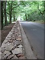


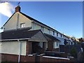

10 photos from this area
Area Information
Key information about the CF71 7UP including its size, population, and administrative classification.
- Area Type
- Postcode
- Area Size
- 2.4 km²
- Population
- 2308
- Population Density
- 53 people/km²
House Prices in CF71 7UP
19
Properties
£518,750
Average Sold Price
£215,000
Lowest Price
£890,000
Highest Price
Showing 19 properties
| Address | Type | Beds | Baths | Last Sale Price | Last Sale Date | |
|---|---|---|---|---|---|---|
| Cross House, Lane Pendoylan Road Clawdd Coch To Junction 34 M 4 Miskin, Clawddcoch, CF71 7UP | house | 3 | 3 | £710,000 | Jun 2024 | |
| 1, Castell Bach Cottages, Lane Pendoylan Road Clawdd Coch To Junction 34 M 4 Miskin, Clawddcoch, CF71 7UP | house | - | - | £215,000 | Jan 2018 | |
| Chapel View Barn, Pont Sarn Lane, Clawddcoch, CF71 7UP | Detached | - | - | £890,000 | Dec 2007 | |
| Ty Cadno, Pont Sarn Lane, Clawddcoch, CF71 7UP | Bungalow | 3 | 2 | £260,000 | May 2005 | |
| Duffryn Bach, Lane Pendoylan Road Clawdd Coch To Junction 34 M 4 Miskin, Clawddcoch, CF71 7UP | Detached | - | - | - | - | |
| Duffryn Mawr Farm, Pont Sarn Lane, Clawddcoch, CF71 7UP | Detached | - | - | - | - | |
| Bryn Farm, Pont Sarn Lane, Clawddcoch, CF71 7UP | house | - | - | - | - | |
| Clawddcoch Farm House, Lane Pendoylan Road Clawdd Coch To Junction 34 M 4 Miskin, Clawddcoch, CF71 7UP | Detached | - | - | - | - | |
| Chapel House, Lane Pendoylan Road Clawdd Coch To Junction 34 M 4 Miskin, Clawddcoch, CF71 7UP | house | - | - | - | - | |
| The Paddock, Lane Pendoylan Road Clawdd Coch To Junction 34 M 4 Miskin, Clawddcoch, CF71 7UP | Detached | - | - | - | - |
Page 1 of 2
Energy Efficiency in CF71 7UP
Amenities
Schools
| Rank | School | Type | Entry gender | Ages |
|---|
Explore more schools in this area
Go to Schools tabDemographics
Household Size
Two person
most common
Accommodation Type
Houses
most common
Tenure
88
majority
Ethnic Group
White
most common
Religion
N/A
most common
Household Composition
N/A
most common
Age
47
median
Adults (30-64 years)
most common
Household Deprivation
N/A
with no deprivation
NS-SEC
54
in Lower managerial occupations
Explore more demographic insights in this area
Go to Demographics tabPlanning
Planning Constraints
- Flood RiskPremium
- Ramsar Wetland SitesPremium
- Area of Outstanding Natural BeautyPremium
- Protected Nature ReservePremium
- Protected WoodlandPremium
- Crime RiskPremium