Area Overview for CF64 3HQ
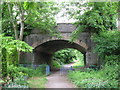
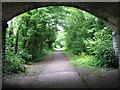
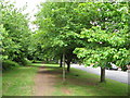
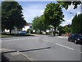
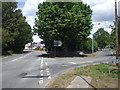
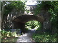
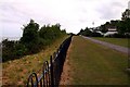
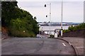
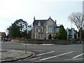
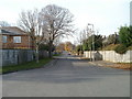
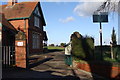
Photos of CF64 3HQ

Area Information
CF64 3HQ represents a specific residential cluster within Penarth, a seaside town on the north shore of the Severn Estuary. This postcode covers an area of 9896 m² that fits a small population of 1,930 people. The location sits approximately 5 miles southwest of Cardiff, offering residents a coastal lifestyle while maintaining proximity to the capital. Living in this part of Penarth means accessing a Victorian-era resort town that has evolved from industrial docks to a desirable commuter locale. The area blends historic charm with modern residential development, defined by waterfront attractions and a quiet suburban atmosphere. Neighbours here enjoy the benefits of being in a former urban district that absorbed council housing after World War II before becoming part of Vale of Glamorgan Council in 1974. The community sits close to key landmarks like Penarth Pier and the conservation area, making daily life convenient for those who value coastal access. Skipping past the postcode technicalities, you find a setting where history meets contemporary family living in a compact, well-defined neighbourhood. The small footprint of this cluster suggests a focused residential environment rather than sprawling development.
- Area Type
- Postcode
- Area Size
- 9896 m²
- Population
- 1930
- Population Density
- 3662 people/km²
Looking at homes in CF64 3HQ, you will find a market dominated by owner-occupiers. The 83% home ownership rate indicates that renting is less common here compared to urban centres. Houses make up the primary accommodation type, matching the Victorian-era villas and post-war developments that characterize Penarth's housing stock. This small residential cluster favours permanent residents who have invested in their front doors. Buyers should note that the high ownership percentage often correlates with lower turnover, meaning properties may stay on the market longer. The mix includes middle-class villas alongside former working-class areas, creating a varied but predominantly family-oriented stock. Private housing growth since the 1980s has added modern properties to the historic fabric, though the core remains traditional. If you are considering purchasing, high ownership levels suggest a stable environment where neighbours often sell only due to life changes rather than financial pressure. The presence of houses as the main accommodation type rules out the high-rise or flat-focused markets found elsewhere in the region.
House Prices in CF64 3HQ
Showing 11 properties
| Address | Type | Beds | Baths | Last Sale Price | Last Sale Date | |
|---|---|---|---|---|---|---|
| 3 Lower Cwrt Y Vil Road, Penarth, CF64 3HQ | Detached | 7 | 3 | - | - | |
| 7 Lower Cwrt Y Vil Road, Penarth, CF64 3HQ | Semi-detached | 6 | - | - | - | |
| 1 Lower Cwrt Y Vil Road, Penarth, CF64 3HQ | Semi-detached | 3 | - | - | - | |
| Netherwood, 8 Lower Cwrt Y Vil Road, Penarth, CF64 3HQ | house | - | - | - | - | |
| Bancroft, 4 Lower Cwrt Y Vil Road, Penarth, CF64 3HQ | house | - | - | - | - | |
| Glasfryn, 11 Lower Cwrt Y Vil Road, Penarth, CF64 3HQ | house | - | - | - | - | |
| 6 Lower Cwrt Y Vil Road, Penarth, CF64 3HQ | Semi-detached | - | - | - | - | |
| 10 Lower Cwrt Y Vil Road, Penarth, CF64 3HQ | Semi-detached | - | - | - | - | |
| Oakwood, 9 Lower Cwrt Y Vil Road, Penarth, CF64 3HQ | Semi-detached | - | - | - | - | |
| All Saints Vicarage, 2 Lower Cwrt Y Vil Road, Penarth, CF64 3HQ | house | - | - | - | - |
Energy Efficiency in CF64 3HQ
Your daily life in CF64 3HQ revolves around specific amenities that sit within practical reach. Local shopping is handled by Spar, Tesco Penarth, and Co-op Windsor, providing essentials without needing a long drive. For commuters, Penarth Railway Station, Dingle Road Railway Station, and Cogan Railway Station form a vital rail backbone. Penarth Pier, Barrage South Waterbus Stop, and Barrage North Waterbus Stop offer scenic ferry connections across the estuary. The Cardiff Bus Interchange provides broader bus network access for journeys further afield. These facilities create a convenient loop around your home that prioritises local needs and leisure. You do not need to travel deep into the city centre for routine tasks. The combination of retail, rail, and ferry services means you can choose the mode of transport that best suits your day. Whether walking to the Spar for groceries or catching the train to Cardiff, the infrastructure supports a varied lifestyle. Historic venues like the art deco Pier Pavilion also provide cultural and community spaces nearby.
Amenities
Schools
| Rank | School | Type | Entry gender | Ages |
|---|
Explore more schools in this area
Go to Schools tabDemographics
The community inside CF64 3HQ is defined by older residents with a median age of 47 years. Most common age groups include adults between 30 and 64 years, indicating a population that has settled for the long term. Home ownership stands at 83%, meaning the vast majority of residents own their property outright or with a mortgage. Houses dominate the accommodation type, reflecting the area's character as a place for families and established households rather than young professionals in rented flats. The predominant ethnic group is White, aligning with the broader demographic trends found across many established Welsh coastal towns. With such a high ownership rate, the area attracts buyers seeking stability over flexibility. The age profile suggests neighbourhoods run by adults with significant local knowledge who have watched the town grow from 1,898 residents in 1861 to its current scale. This demographic stability contributes to a consistent community feel where long-term residents are more likely than newcomers to manage local affairs and social networks.
Household Size
Accommodation Type
Tenure
Ethnic Group
Religion
Household Composition
Age
Household Deprivation
NS-SEC
Explore more demographic insights in this area
Go to Demographics tabPlanning
Planning Constraints
- Flood RiskPremium
- Ramsar Wetland SitesPremium
- Area of Outstanding Natural BeautyPremium
- Protected Nature ReservePremium
- Protected WoodlandPremium
- Crime RiskPremium