Area Overview for CF64 2NE
Photos of CF64 2NE
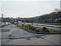
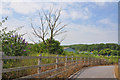
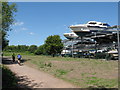
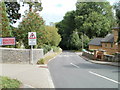
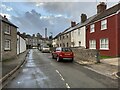
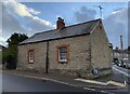
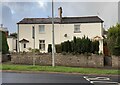
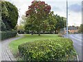
63 photos from this area
Area Information
Key information about the CF64 2NE including its size, population, and administrative classification.
- Area Type
- Postcode
- Area Size
- 1.4 hectares
- Population
- 2090
- Population Density
- 1242 people/km²
House Prices in CF64 2NE
24
Properties
£351,738
Average Sold Price
£220,000
Lowest Price
£560,050
Highest Price
Showing 24 properties
| Address | Type | Beds | Baths | Last Sale Price | Last Sale Date | |
|---|---|---|---|---|---|---|
| 17 Canon Walk, Llandough, Penarth, CF64 2NE | Detached | 4 | 3 | £430,000 | Aug 2025 | |
| 22 Canon Walk, Llandough, Penarth, CF64 2NE | Detached | 4 | 1 | £560,050 | May 2025 | |
| 23 Canon Walk, Llandough, Penarth, CF64 2NE | Detached | 4 | 2 | £460,000 | Nov 2023 | |
| 10 Canon Walk, Llandough, Penarth, CF64 2NE | house | - | - | £220,000 | Jun 2021 | |
| 14 Canon Walk, Llandough, Penarth, CF64 2NE | house | - | - | £220,000 | Apr 2021 | |
| 1 Canon Walk, Llandough, Penarth, CF64 2NE | Detached | 4 | 2 | £355,000 | Oct 2017 | |
| 16 Canon Walk, Llandough, Penarth, CF64 2NE | house | - | - | £284,500 | Jun 2016 | |
| 15 Canon Walk, Llandough, Penarth, CF64 2NE | house | - | - | £409,995 | Jun 2016 | |
| 24 Canon Walk, Llandough, Penarth, CF64 2NE | Detached | 4 | 3 | £459,995 | May 2016 | |
| 3 Canon Walk, Llandough, Penarth, CF64 2NE | house | - | - | £400,000 | May 2016 |
Page 1 of 3
Energy Efficiency in CF64 2NE
Amenities
Schools
| Rank | School | Type | Entry gender | Ages |
|---|---|---|---|---|
| 1 | Llandough Primary | other | N/A | N/A |
Explore more schools in this area
Go to Schools tabDemographics
Household Size
Two person
most common
Accommodation Type
Houses
most common
Tenure
76
majority
Ethnic Group
White
most common
Religion
N/A
most common
Household Composition
N/A
most common
Age
47
median
Adults (30-64 years)
most common
Household Deprivation
N/A
with no deprivation
NS-SEC
43
in Lower managerial occupations
Explore more demographic insights in this area
Go to Demographics tabPlanning
Planning Constraints
- Flood RiskPremium
- Ramsar Wetland SitesPremium
- Area of Outstanding Natural BeautyPremium
- Protected Nature ReservePremium
- Protected WoodlandPremium
- Crime RiskPremium