Area Overview for CF64 1EL
Photos of CF64 1EL
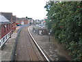
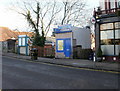
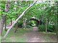
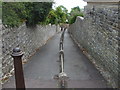
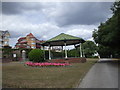
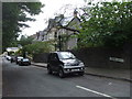
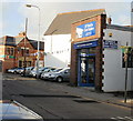
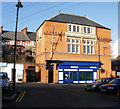
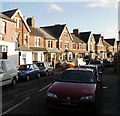

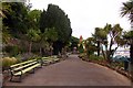
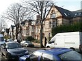
100 photos from this area
Area Information
Key information about the CF64 1EL including its size, population, and administrative classification.
- Area Type
- Postcode
- Area Size
- 6953 m²
- Population
- 1426
- Population Density
- 4720 people/km²
House Prices in CF64 1EL
29
Properties
£232,023
Average Sold Price
£140,950
Lowest Price
£325,000
Highest Price
Showing 29 properties
| Address | Type | Beds | Baths | Last Sale Price | Last Sale Date | |
|---|---|---|---|---|---|---|
| 104 Plassey Street, Penarth, CF64 1EL | Terraced | 3 | 2 | £325,000 | Jan 2025 | |
| The Coach House, Plassey Street, Penarth, CF64 1EL | house | 1 | 1 | £202,000 | Feb 2024 | |
| 43 Plassey Street, Penarth, CF64 1EL | house | 3 | 2 | £245,000 | Aug 2022 | |
| 37 Plassey Street, Penarth, CF64 1EL | Terraced | 2 | 1 | £318,500 | Jul 2022 | |
| 101 Plassey Street, Penarth, CF64 1EL | Terraced | 3 | 1 | £272,500 | Jan 2022 | |
| 41 Plassey Street, Penarth, CF64 1EL | house | 3 | - | £310,000 | Jul 2021 | |
| 107 Plassey Street, Penarth, CF64 1EL | Terraced | 2 | 4 | £312,940 | Jul 2019 | |
| 40 Plassey Street, Penarth, CF64 1EL | house | - | - | £205,000 | Jan 2017 | |
| 99 Plassey Street, Penarth, CF64 1EL | Terraced | 2 | 1 | £230,000 | Jul 2016 | |
| 100 Plassey Street, Penarth, CF64 1EL | Terraced | 4 | 1 | £166,500 | May 2013 |
Page 1 of 3
Energy Efficiency in CF64 1EL
Amenities
Schools
| Rank | School | Type | Entry gender | Ages |
|---|---|---|---|---|
| 1 | Bute Cottage Nursery School | other | N/A | N/A |
| 2 | Penarth C.I.W. Primary | other | N/A | N/A |
| 3 | Westbourne Schools | other | N/A | N/A |
| 4 | Llantwit Major Youth Centre | other | N/A | N/A |
Explore more schools in this area
Go to Schools tabDemographics
Household Size
One person
most common
Accommodation Type
Houses
most common
Tenure
78
majority
Ethnic Group
White
most common
Religion
N/A
most common
Household Composition
N/A
most common
Age
47
median
Adults (30-64 years)
most common
Household Deprivation
N/A
with no deprivation
NS-SEC
46
in Lower managerial occupations
Explore more demographic insights in this area
Go to Demographics tabPlanning
Planning Constraints
- Flood RiskPremium
- Ramsar Wetland SitesPremium
- Area of Outstanding Natural BeautyPremium
- Protected Nature ReservePremium
- Protected WoodlandPremium
- Crime RiskPremium