Area Overview for CF64 1BY
Photos of CF64 1BY
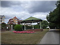
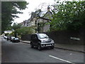
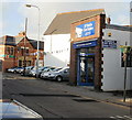
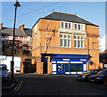
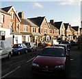
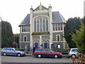
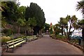
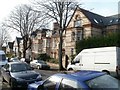
100 photos from this area
Area Information
Key information about the CF64 1BY including its size, population, and administrative classification.
- Area Type
- Postcode
- Area Size
- 2801 m²
- Population
- 1462
- Population Density
- 8046 people/km²
House Prices in CF64 1BY
40
Properties
£201,667
Average Sold Price
£70,000
Lowest Price
£345,000
Highest Price
Showing 40 properties
| Address | Type | Beds | Baths | Last Sale Price | Last Sale Date | |
|---|---|---|---|---|---|---|
| Ty Losin, 31A Albert Road, Penarth, CF64 1BY | Terraced | 3 | 3 | £190,000 | Dec 2024 | |
| 33 Albert Road, Penarth, CF64 1BY | Terraced | 1 | 1 | £345,000 | Jul 2009 | |
| 35C Albert Road, Penarth, CF64 1BY | Flat | - | - | £70,000 | Oct 1997 | |
| Source Of Beauty, 31B Albert Road, Penarth, CF64 1BY | Terraced | 2 | 3 | - | - | |
| 6, Caelum, Alcedonia, Albert Road, Penarth, CF64 1BY | Flat | 2 | 3 | - | - | |
| 7, Magnus, Alcedonia, Albert Road, Penarth, CF64 1BY | Flat | 3 | 3 | - | - | |
| Flat 2, 18 Albert Road, Penarth, CF64 1BY | Flat | - | - | - | - | |
| Flat 3, 18 Albert Road, Penarth, CF64 1BY | Flat | 2 | 1 | - | - | |
| Flat 4 Ground Floor Rear, 18 Albert Road, Penarth, CF64 1BY | Flat | - | - | - | - | |
| 8, Lumen, Alcedonia, Albert Road, Penarth, CF64 1BY | Flat | 2 | 2 | - | - |
Page 1 of 4
Energy Efficiency in CF64 1BY
Amenities
Schools
| Rank | School | Type | Entry gender | Ages |
|---|---|---|---|---|
| 1 | Albert C.P. School | other | N/A | N/A |
Explore more schools in this area
Go to Schools tabDemographics
Household Size
One person
most common
Accommodation Type
Houses
most common
Tenure
64
majority
Ethnic Group
White
most common
Religion
N/A
most common
Household Composition
N/A
most common
Age
47
median
Adults (30-64 years)
most common
Household Deprivation
N/A
with no deprivation
NS-SEC
43
in Lower managerial occupations
Explore more demographic insights in this area
Go to Demographics tabPlanning
Planning Constraints
- Flood RiskPremium
- Ramsar Wetland SitesPremium
- Area of Outstanding Natural BeautyPremium
- Protected Nature ReservePremium
- Protected WoodlandPremium
- Crime RiskPremium