Area Overview for CF62 6SZ
Photos of CF62 6SZ
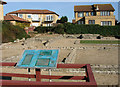
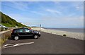
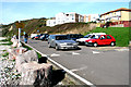
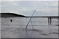
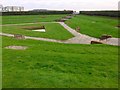
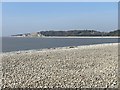
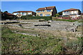
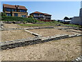
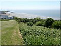
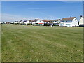
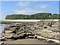
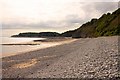
48 photos from this area
Area Information
Key information about the CF62 6SZ including its size, population, and administrative classification.
- Area Type
- Postcode
- Area Size
- 3.3 hectares
- Population
- 1401
- Population Density
- 1525 people/km²
House Prices in CF62 6SZ
18
Properties
£363,994
Average Sold Price
£157,000
Lowest Price
£645,000
Highest Price
Showing 18 properties
| Address | Type | Beds | Baths | Last Sale Price | Last Sale Date | |
|---|---|---|---|---|---|---|
| Jovale, 20 Maes Y Coed, Barry, CF62 6SZ | Detached | 4 | 2 | £645,000 | Jun 2024 | |
| Can-yr-aderyn, 22 Maes Y Coed, Barry, CF62 6SZ | house | - | - | £340,000 | Nov 2012 | |
| Glan Hafren, 10 Maes Y Coed, Barry, CF62 6SZ | Detached | - | - | £330,000 | Aug 2009 | |
| Carreg Wen, 4 Maes Y Coed, Barry, CF62 6SZ | Detached | 4 | 2 | £429,950 | Jul 2007 | |
| Koggala, 9 Maes Y Coed, Barry, CF62 6SZ | Detached | - | - | £375,000 | Mar 2007 | |
| Ceredigion, 7 Maes Y Coed, Barry, CF62 6SZ | Detached | - | - | £325,000 | Dec 2006 | |
| Ger Y Don, 12 Maes Y Coed, Barry, CF62 6SZ | Detached | 4 | 1 | £310,000 | Jun 2006 | |
| Grassways, 16 Maes Y Coed, Barry, CF62 6SZ | Detached | - | - | £157,000 | Dec 2000 | |
| Sea Breezes, 8 Maes Y Coed, Barry, CF62 6SZ | Semi-detached | 4 | 2 | - | - | |
| Quantum Leap, 1 Maes Y Coed, Barry, CF62 6SZ | Detached | - | - | - | - |
Page 1 of 2
Energy Efficiency in CF62 6SZ
Amenities
Schools
| Rank | School | Type | Entry gender | Ages |
|---|
Explore more schools in this area
Go to Schools tabDemographics
Household Size
Two person
most common
Accommodation Type
Houses
most common
Tenure
94
majority
Ethnic Group
White
most common
Religion
N/A
most common
Household Composition
N/A
most common
Age
47
median
Adults (30-64 years)
most common
Household Deprivation
N/A
with no deprivation
NS-SEC
45
in Lower managerial occupations
Explore more demographic insights in this area
Go to Demographics tabPlanning
Planning Constraints
- Flood RiskPremium
- Ramsar Wetland SitesPremium
- Area of Outstanding Natural BeautyPremium
- Protected Nature ReservePremium
- Protected WoodlandPremium
- Crime RiskPremium