Area Overview for CF62 4PR
Photos of CF62 4PR


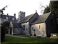
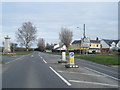
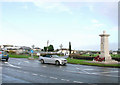
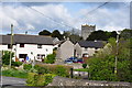

100 photos from this area
Area Information
Key information about the CF62 4PR including its size, population, and administrative classification.
- Area Type
- Postcode
- Area Size
- 1.4 hectares
- Population
- 1700
- Population Density
- 308 people/km²
House Prices in CF62 4PR
36
Properties
£129,897
Average Sold Price
£38,000
Lowest Price
£248,000
Highest Price
Showing 36 properties
| Address | Type | Beds | Baths | Last Sale Price | Last Sale Date | |
|---|---|---|---|---|---|---|
| 31 Glebeland Place, St Athan, CF62 4PR | Semi-detached | 3 | 1 | £248,000 | Nov 2024 | |
| 60 Glebeland Place, St Athan, CF62 4PR | Terraced | 3 | 1 | £175,000 | Jan 2023 | |
| 26 Glebeland Place, St Athan, CF62 4PR | Semi-detached | 3 | - | £145,000 | Feb 2020 | |
| 40 Glebeland Place, St Athan, CF62 4PR | Semi-detached | 3 | 1 | £167,500 | Dec 2019 | |
| 32 Glebeland Place, St Athan, CF62 4PR | Semi-detached | 3 | 1 | £180,000 | Sep 2019 | |
| 41 Glebeland Place, St Athan, CF62 4PR | Semi-detached | 3 | 1 | £195,000 | Dec 2017 | |
| 34 Glebeland Place, St Athan, CF62 4PR | Semi-detached | - | - | £123,000 | Sep 2015 | |
| 18 Glebeland Place, St Athan, CF62 4PR | Semi-detached | 3 | 1 | £112,750 | Jun 2015 | |
| 28 Glebeland Place, St Athan, CF62 4PR | house | - | - | £125,000 | Apr 2015 | |
| 50 Glebeland Place, St Athan, CF62 4PR | Terraced | - | - | £105,000 | Oct 2014 |
Page 1 of 4
Energy Efficiency in CF62 4PR
Amenities
Schools
| Rank | School | Type | Entry gender | Ages |
|---|
Explore more schools in this area
Go to Schools tabDemographics
Household Size
Two person
most common
Accommodation Type
Houses
most common
Tenure
67
majority
Ethnic Group
White
most common
Religion
N/A
most common
Household Composition
N/A
most common
Age
47
median
Adults (30-64 years)
most common
Household Deprivation
N/A
with no deprivation
NS-SEC
29
in Lower managerial occupations
Explore more demographic insights in this area
Go to Demographics tabPlanning
Planning Constraints
- Flood RiskPremium
- Ramsar Wetland SitesPremium
- Area of Outstanding Natural BeautyPremium
- Protected Nature ReservePremium
- Protected WoodlandPremium
- Crime RiskPremium