Area Overview for CF61 2XR
Photos of CF61 2XR
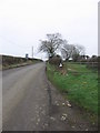

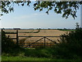
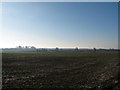
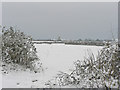
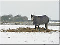
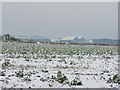
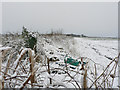

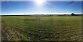
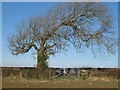
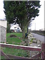
14 photos from this area
Area Information
Key information about the CF61 2XR including its size, population, and administrative classification.
- Area Type
- Postcode
- Area Size
- 5.3 km²
- Population
- 1817
- Population Density
- 183 people/km²
House Prices in CF61 2XR
100
Properties
£417,097
Average Sold Price
£94,500
Lowest Price
£1,400,000
Highest Price
Showing 100 properties
| Address | Type | Beds | Baths | Last Sale Price | Last Sale Date | |
|---|---|---|---|---|---|---|
| Bridge House Farm, Llanmaes Road, Llanmaes, CF61 2XR | house | - | - | £410,000 | May 2024 | |
| The Croft, Lane Junction Brook Farm To Llanmaes Village Road Via Blacksmith Arms, Llanmaes, CF61 2XR | house | 3 | 2 | £625,000 | Aug 2023 | |
| Castle Lodge, Llanmaes Village, Llanmaes, CF61 2XR | house | - | - | £620,000 | May 2023 | |
| Bwthyn Bach, Lane Junction Froglands Farm To Llanmaes Village Via Caravan Park, Llanmaes, CF61 2XR | house | - | - | £400,000 | Jan 2023 | |
| Maes-yr-haf, 0 , Llanmaes, Llantwit Major, CF61 2XR | Detached | 4 | 1 | £450,000 | Oct 2022 | |
| Dunraven Cottage, 0 , Llanmaes, Llantwit Major, CF61 2XR | Detached | 3 | 3 | £635,000 | Sep 2022 | |
| Hillview, Llanmaes Village, Llanmaes, CF61 2XR | house | - | - | £688,000 | Sep 2022 | |
| Pen Y Bryn Barns, Lane From Peny Y Bryn West To Sigingstone, Llanmaes, CF61 2XR | Semi-detached | - | - | £1,400,000 | May 2022 | |
| Malefant House, Lane Junction Froglands Farm To Llanmaes Village Via Caravan Park, Llanmaes, CF61 2XR | Detached | 4 | 3 | £695,000 | May 2022 | |
| Springside, Llanmaes Village, Llanmaes, CF61 2XR | Detached | 4 | - | £430,000 | Sep 2021 |
Page 1 of 10
Energy Efficiency in CF61 2XR
Amenities
Schools
| Rank | School | Type | Entry gender | Ages |
|---|
Explore more schools in this area
Go to Schools tabDemographics
Household Size
One person
most common
Accommodation Type
Houses
most common
Tenure
60
majority
Ethnic Group
White
most common
Religion
N/A
most common
Household Composition
N/A
most common
Age
47
median
Adults (30-64 years)
most common
Household Deprivation
N/A
with no deprivation
NS-SEC
39
in Lower managerial occupations
Explore more demographic insights in this area
Go to Demographics tabPlanning
Planning Constraints
- Flood RiskPremium
- Ramsar Wetland SitesPremium
- Area of Outstanding Natural BeautyPremium
- Protected Nature ReservePremium
- Protected WoodlandPremium
- Crime RiskPremium