Area Overview for CF61 2UQ
Photos of CF61 2UQ


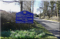

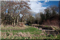


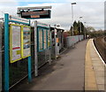
100 photos from this area
Area Information
Key information about the CF61 2UQ including its size, population, and administrative classification.
- Area Type
- Postcode
- Area Size
- 9352 m²
- Population
- 1348
- Population Density
- 6198 people/km²
House Prices in CF61 2UQ
23
Properties
£120,996
Average Sold Price
£20,445
Lowest Price
£210,000
Highest Price
Showing 23 properties
| Address | Type | Beds | Baths | Last Sale Price | Last Sale Date | |
|---|---|---|---|---|---|---|
| 19 Greys Drive, Boverton, Llantwit Major, CF61 2UQ | Terraced | 3 | 2 | £187,000 | May 2025 | |
| 15 Greys Drive, Boverton, Llantwit Major, CF61 2UQ | house | - | - | £210,000 | Jun 2021 | |
| 9 Greys Drive, Boverton, Llantwit Major, CF61 2UQ | Terraced | 3 | - | £185,000 | Jun 2021 | |
| 13 Greys Drive, Boverton, Llantwit Major, CF61 2UQ | house | - | - | £166,000 | Sep 2020 | |
| 10 Greys Drive, Boverton, Llantwit Major, CF61 2UQ | Terraced | 3 | - | £140,000 | Jan 2020 | |
| 6 Greys Drive, Boverton, Llantwit Major, CF61 2UQ | Terraced | 3 | 2 | £165,000 | Oct 2019 | |
| 12 Greys Drive, Boverton, Llantwit Major, CF61 2UQ | Terraced | 3 | - | £126,000 | Sep 2019 | |
| 21 Greys Drive, Boverton, Llantwit Major, CF61 2UQ | Terraced | 3 | - | £140,000 | May 2017 | |
| 18 Greys Drive, Boverton, Llantwit Major, CF61 2UQ | Terraced | 3 | 1 | £123,500 | Nov 2014 | |
| 8 Greys Drive, Boverton, Llantwit Major, CF61 2UQ | house | - | - | £133,000 | Jun 2007 |
Page 1 of 3
Energy Efficiency in CF61 2UQ
Amenities
Schools
| Rank | School | Type | Entry gender | Ages |
|---|---|---|---|---|
| 1 | Eagleswell Primary | other | N/A | N/A |
Explore more schools in this area
Go to Schools tabDemographics
Household Size
Family (3-5 people)
most common
Accommodation Type
Houses
most common
Tenure
54
majority
Ethnic Group
White
most common
Religion
N/A
most common
Household Composition
N/A
most common
Age
47
median
Adults (30-64 years)
most common
Household Deprivation
N/A
with no deprivation
NS-SEC
25
in Lower managerial occupations
Explore more demographic insights in this area
Go to Demographics tabPlanning
Planning Constraints
- Flood RiskPremium
- Ramsar Wetland SitesPremium
- Area of Outstanding Natural BeautyPremium
- Protected Nature ReservePremium
- Protected WoodlandPremium
- Crime RiskPremium