Area Overview for CF32 0SN
Photos of CF32 0SN
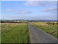
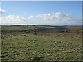
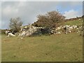
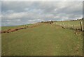
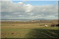

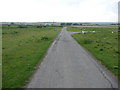
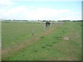
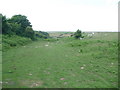
21 photos from this area
Area Information
Key information about the CF32 0SN including its size, population, and administrative classification.
- Area Type
- Postcode
- Area Size
- 1.4 km²
- Population
- 1637
- Population Density
- 117 people/km²
House Prices in CF32 0SN
10
Properties
£537,714
Average Sold Price
£335,000
Lowest Price
£860,000
Highest Price
Showing 10 properties
| Address | Type | Beds | Baths | Last Sale Price | Last Sale Date | |
|---|---|---|---|---|---|---|
| Pleasant View, Heol Y Mynydd, Southerndown, CF32 0SN | Detached | 3 | 2 | £410,000 | Sep 2020 | |
| Ty Groes, Heol Y Mynydd, Southerndown, CF32 0SN | Detached | 3 | 1 | £400,000 | Apr 2019 | |
| Wayside, Heol Y Mynydd, Southerndown, CF32 0SN | house | - | - | £575,000 | Feb 2018 | |
| Rose Cottage, Heol Y Mynydd, Southerndown, CF32 0SN | Detached | 5 | - | £609,000 | Apr 2015 | |
| Pen Y Mynydd, Heol Y Mynydd, Southerndown, CF32 0SN | house | - | - | £860,000 | Dec 2011 | |
| Bryn-teg, Heol Y Mynydd, Southerndown, CF32 0SN | Detached | - | - | £575,000 | Oct 2010 | |
| Mynfa, Heol Y Mynydd, Southerndown, CF32 0SN | Detached | - | - | £335,000 | Sep 2002 | |
| Woodbine Cottage, Heol Y Mynydd, Southerndown, CF32 0SN | Cottage | 4 | 2 | - | - | |
| Evergreen Cottage, Heol Y Mynydd, Southerndown, CF32 0SN | house | - | - | - | - | |
| Greengate Cottage, Heol Y Mynydd, Southerndown, CF32 0SN | house | - | - | - | - |
Energy Efficiency in CF32 0SN
Amenities
Schools
| Rank | School | Type | Entry gender | Ages |
|---|
Explore more schools in this area
Go to Schools tabDemographics
Household Size
Two person
most common
Accommodation Type
Houses
most common
Tenure
86
majority
Ethnic Group
White
most common
Religion
N/A
most common
Household Composition
N/A
most common
Age
47
median
Adults (30-64 years)
most common
Household Deprivation
N/A
with no deprivation
NS-SEC
56
in Lower managerial occupations
Explore more demographic insights in this area
Go to Demographics tabPlanning
Planning Constraints
- Flood RiskPremium
- Ramsar Wetland SitesPremium
- Area of Outstanding Natural BeautyPremium
- Protected Nature ReservePremium
- Protected WoodlandPremium
- Crime RiskPremium