Area Overview for St. Donats Community
Photos of St. Donats Community
Area Information
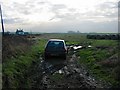
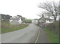
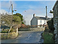
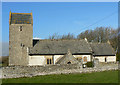
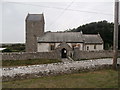
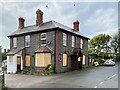
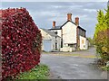
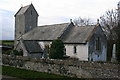
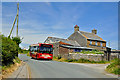
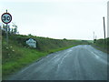
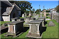
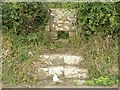
Living in St. Donats Community offers a grounded experience within a civil parish that covers 14.0 km². This village and parish sits in the Vale of Glamorgan, situated just west of Llantwit Major. The area includes the hamlet of Marcross as well as the specific settlements of Monknash, East Monkton and West Monkton. History defines the streets here, with the local name deriving from the 6th-century saint Dunwyd. You will find yourself walking past St Donat's Castle, a 12th-century structure perched on cliffs overlooking the Bristol Channel. The castle currently serves as Atlantic College, a boarding school for international students, and hosts the St Donats Arts Centre nearby. The parish contains the Grade I listed St Donats Church, which stands dedicated to St Dunwyd and holds ancient monuments including a medieval cross. This location combines ancient heritage with modern educational institutions while maintaining its identity as a distinct community entity. The 2011 population recorded 732 residents, indicating a small, tight-knit population size typical for a rural parish of this scale. Daily life here revolves around the specific landmarks that give this part of south Wales its character.
- Area Type
- Parish
- Area Size
- 14.0 km²
- Population
- Not available
- Population Density
- Not available
Demographics
The community profile within St. Donats Community shows a distinctly mature population. The median age stands at 70 years, indicating that most residents fall into older age brackets rather than young families or working-age adults. Although the data does not specify the dominant age range beyond the total count, the high median age suggests a retirement or semi-retired demographic. Home ownership remains significant within the locality, with 75% of households reporting ownership of their properties. This high figure points to a neighbourhood where residents have established long-term roots rather than a transient rental market. You will find that accommodation diversity exists, though specific breakdowns of house types or room counts are not detailed in current records. Ethnic and religious diversity data are currently unavailable for this specific parish, meaning you cannot determine the precise composition of the community based on these metrics alone. Deprivation levels are not explicitly quantified in the provided information, so you must view the high home ownership rate as the primary indicator of economic stability. The population density of 732 people across 14.0 km² creates a quiet environment suited to those seeking a slower pace away from city centres.
Household Size
Accommodation Type
Tenure
Ethnic Group
Religion
Household Composition
Age
Household Deprivation
NS-SEC
Explore more demographic insights in this area
Go to Demographics tabPlanning
Planning Constraints
- Flood RiskPremium
- Ramsar Wetland SitesPremium
- Area of Outstanding Natural BeautyPremium
- Protected Nature ReservePremium
- Protected WoodlandPremium
- Crime RiskPremium