Area Overview for St. Athan Community
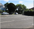
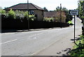
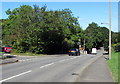
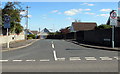
Photos of St. Athan Community
Area Information
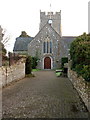
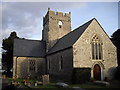
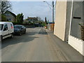
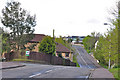
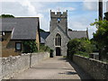
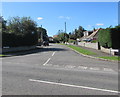
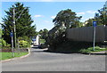
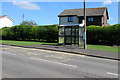
St. Athan Community sits as a distinct civil parish within the Vale of Glamorgan, covering an area of 12.6 km². The village lies off the B4265 road, positioned between Barry and Llantwit Major. You are roughly eight miles north-west of Barry, with historical boundaries stretching towards Eglwys Brewis to the north and the Bristol Channel to the south. Life here revolves around a historic core dominated by St Tathan's Church, which anchors the daily rhythm of the parish. The area functions as a rural village with a small cluster of amenities, including a couple of shops, three pubs, a football team, and a local library. Former military housing blends with traditional residential properties in this setting. The sense of place is defined by tangible history, from the 13th-century church featuring Norman effigies to the East Orchard Castle built in 1691. Daily life involves navigating the quiet roads near the River Thaw and exploring nearby woodlands. The adjacent dormitory village of Eglwys Brewis extends the residential footprint of the community. While the area lacks recent railway services, discussions for a new station continue alongside the historic Eglwys Brewis and Castleton to the north. Those living in St. Athan Community enjoy proximity to the golf course operated by the former RAF base while stepping back from the pace of major towns. The parish offers a grounded environment where history and modern living intersect without the density of urban centres.
- Area Type
- Parish
- Area Size
- 12.6 km²
- Population
- Not available
- Population Density
- Not available
Demographics
The community in St. Athan Community has a defined age structure, with a median age of 70 years. This figure indicates a resident base that is significantly older than the national average. Many homes in St. Athan Community are occupied by retirees or older residents seeking a slower pace of life. The historical record confirms decades of growth, with families establishing homes near the church dating back over 600 years. Current census data shows that 64% of households own their property outright or with a mortgage. This high ownership rate suggests stability within the local housing stock rather than a transient rental population. You can expect a quiet atmosphere where long-term residents remain in their houses for extended periods. The demographic profile reflects a desire for stability and a connection to the local environment. Historical families like the Berkerolles have held land in this parish since the 13th century, influencing the current character of the neighbourhood. While specific metrics on household composition diversity are not numerically detailed, the cumulative effect of a high median age suggests a population focused on retirement living. Those buying homes in St. Athan Community are likely joining a community where traditions of stewardship in land and housing persist into the modern era. The age profile directly influences the types of social groups you will encounter when visiting local pubs or the school.
Household Size
Accommodation Type
Tenure
Ethnic Group
Religion
Household Composition
Age
Household Deprivation
NS-SEC
Explore more demographic insights in this area
Go to Demographics tabPlanning
Planning Constraints
- Flood RiskPremium
- Ramsar Wetland SitesPremium
- Area of Outstanding Natural BeautyPremium
- Protected Nature ReservePremium
- Protected WoodlandPremium
- Crime RiskPremium