Area Overview for Llandough Community
Photos of Llandough Community
Area Information
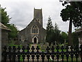
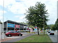
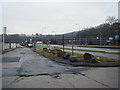
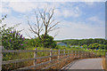
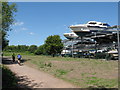
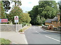
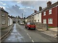
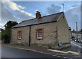
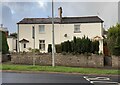
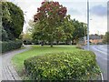
Living in Llandough Community offers a distinct character shaped by its history and modest scale. This civil parish sits within the Vale of Glamorgan, serving as a quiet residential neighbour to Penarth. You will find the area occupies just 1.7 km² of land, which concentrates the local population into a tight-knit environment. The village currently holds a population of approximately 2,090 residents. Today, the settlement functions primarily as a suburban residential zone rather than its earlier incarnation. Its roots date back to the early Christian era, when St Dochau established the monastic community Bangor Dochau between 370 and 640 AD. Evidence of Roman occupation also exists in the local landscape. The modern housing stock developed significantly from the mid-1960s, transforming the old farming and quarrying settlement into the village you see now. Steeped in heritage, the area features the National School, first built in 1825, which stands as a testament to its educational history. The current St Dochdwy's Church, designed by S. C. Fripp and completed in 1866, houses origins stretching back to the eighth century. Residents enjoy proximity to significant landmarks such as Llandough Castle, built for Sir Mathew Cradock, and the Llandough Institute, a war memorial hall opened in 1924. This blend of ancient history and mid-century housing expansion defines what it means to call Llandough home.
- Area Type
- Parish
- Area Size
- 1.7 km²
- Population
- Not available
- Population Density
- Not available
Demographics
The community reflects a settled demographic profile dominated by older residents. You will find that the median age in Llandough is 70 years, indicating a population skewed towards retirement. The data categorises the age distribution under a single 'Total' range, confirming the absence of a broad working-age demographic in the standard breakdowns. Of the total households, 76 percent of residents own their homes outright or with a mortgage. This high ownership rate suggests a stable, long-term resident base rather than a transient population. The parish shows no specific breakdown for household composition, ethnicity, or religion due to the lack of detailed data in the current records. While the exact nature of these groups remains unquantified in this dataset, the overall picture points to a mature social environment. The high level of home ownership contributes to community cohesion, as owners typically invest more in their local surroundings. Living in Llandough Community means joining a neighbourhood where the majority of neighbours have stayed for decades. The area does not show signs of recent, large-scale migration or high-density renting. This demographic stability offers a predictable and consistent social fabric for those considering a move. You should expect a quiet, perhaps slow-paced lifestyle typical of areas with such an advanced age profile.
Household Size
Accommodation Type
Tenure
Ethnic Group
Religion
Household Composition
Age
Household Deprivation
NS-SEC
Explore more demographic insights in this area
Go to Demographics tabPlanning
Planning Constraints
- Flood RiskPremium
- Ramsar Wetland SitesPremium
- Area of Outstanding Natural BeautyPremium
- Protected Nature ReservePremium
- Protected WoodlandPremium
- Crime RiskPremium