Area Overview for Llantwit Major Community
Photos of Llantwit Major Community


Area Information
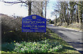
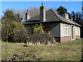
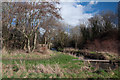
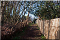
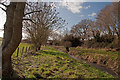
Living in Llantwit Major Community offers a distinct lifestyle within a sheltered valley of the Hodnant on the Ogney Brook. This civil parish spans 17.8 km² and sits about a mile inland from the Bristol Channel. You will find approximately 4,215 residents inhabiting a space that retains a pre-modern feel despite its growth. The area functions as a small rural dormitory town, having expanded rapidly in the 20th century to serve RAF St Athan. Yet, the streets remain narrow and winding, lined with high walls and 16th-century inns. An old town hall stands near Grade I listed St Illtyd's Church, one of Wales's oldest parish churches built between 950 and 1400. You are located within ancient manor and parish boundaries that controlled medieval development. The character of Llantwit Major Community balances this historical depth with modern utility. It was rated as one of Wales's most attractive postcode areas to live in during 2014. Visitors can explore ruins of the monastic school house and tithe barn complex near the Rectory and Grange. St Donat's Castle lies just 1.5 miles west, adding to the visual heritage surrounding your daily routine.
- Area Type
- Parish
- Area Size
- 17.8 km²
- Population
- 4215
- Population Density
- 236 people/km²
Demographics
The community profile of Llantwit Major reveals a significant departure from a young workforce population. The median age is 70, indicating a population skewed heavily towards older residents. This demographic structure suggests a quiet, settled environment rather than a bustling hub for young families or students. You will encounter a society where most households are likely empty nesters or retirees managing daily life with mature experiences. Home ownership stands at 74%, meaning the vast majority of residents own their residences outright or with a mortgage. This high ownership rate reflects long-term stability and a deep-rooted connection to the land. The area encompasses the parish core and surrounding rural fringes, blending historic manor boundaries with modern residential zones. You do not find diverse age mixtures typical of university towns or commuter belts. Instead, the social fabric revolves around neighbours who have lived in the Vale of Glamorgan for decades. The accommodation types reflect this tenure pattern, prioritising single-family homes over purpose-built rentals. As you navigate the neighbourhood, expect a rhythm dictated by the needs of a senior population enjoying retirees' retirement within historic walls.
Household Size
Accommodation Type
Tenure
Ethnic Group
Religion
Household Composition
Age
Household Deprivation
NS-SEC
Explore more demographic insights in this area
Go to Demographics tabPlanning
Planning Constraints
- Flood RiskPremium
- Ramsar Wetland SitesPremium
- Area of Outstanding Natural BeautyPremium
- Protected Nature ReservePremium
- Protected WoodlandPremium
- Crime RiskPremium