Area Overview for Dinas Powys Community
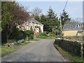
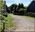
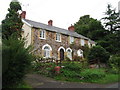
Photos of Dinas Powys Community


Area Information
Living in Dinas Powys Community defines an experience rooted in ancient history within a compact, managed landscape. This community serves as a unitary electoral division located approximately 9km south-west of Cardiff. You navigate 11.4 km² of land that supports a population of roughly 1,520 residents. The settlement derives its name from a prominent Iron Age hillfort, meaning "fort of the provincial place," which dominates the local geography. Human activity here stretches back to the Neolithic period, including evidence of a Stone Age axe-head and early medieval high-status occupation featuring imported glass and metalworking. A Norman ringwork castle dates back to the 11th and 12th centuries, later falling under the ownership of Sir Reginald de Sully. The village expanded rapidly in the late 19th century after a railway link arrived, growing from around 474 people in 1833 to over 2,000 by 1901. Today, you walk past St Peter's Church, a Grade II listed building consecrated in 1930 that incorporates reused masonry from the Cyfarthfa Ironworks. This area balances significant archaeological depth with a modern residential setting near the coast. The mix of protected woodland and open spaces offers a distinct character for those seeking homes in Dinas Powys Community where daily life reflects centuries of continuity. ### The community profile reflects a mature, established population with minimal turnover. The median age sits at 70 years, indicating a retirement-oriented demographic where most residents are elderly. Historical records show the population density remains stable at 134 people per square kilometre across the 11.4 km² subdivision. Home ownership stands at a solid 78%, suggesting a settled constituency rather than a transient rental market. You will likely encounter long-term families and retired couples who have chosen this specific location. The historical expansion from 474 residents in 1833 to a peak of over 2,000 by 1901 highlights how transport infrastructure shapes population growth in Wales. Currently, the area contains approximately 1,520 people living in this unitary electoral division. The dominance of older residents means the local shops and services cater primarily to a mature demographic. When you consider schools near Dinas Powys Community, note that the resident base is too young for public education, so most families travelling there do so for childcare or proximity to Cardiff. You can expect a quiet neighbourhood where the elderly population dictates the social rhythm. This demographic reality makes Dinas Powys attractive for those seeking a peaceful environment rather than a family hub. ### The housing stock in Dinas Powys Community is characterised by extremely high retention rates and limited turnover. A striking 78% of residents own their homes outright or with a mortgage, confirming this as a predominantly owner-occupied area. This high ownership figure suggests that the 1,520 people residing in Dinas Powys are deeply rooted in their properties. You will find very few private landlords managing rental units within these 11.4 km² boundaries. The accommodation types reflect the historical development patterns seen after the railway link arrived in the late 19th century. Most properties date back to that expansion period or earlier, creating a consistent architectural character. Because nearly four out of five residents are owners, resale activity can sometimes be slower than in commuter hubs with frequent changing hands. If you are looking for homes in Dinas Powys Community, competition for properties may be fierce as sellers hold on to their assets. The low density of 134 people per square kilometre supports smaller homes or bungalows suitable for older occupants. There is little evidence of rapid gentrification because the median age of 70 discourages young professionals from entering the market frequently. This stability benefits homeowners who wish to live in a predictable environment. However, first-time buyers may find the 11.4 km² area offers fewer opportunities given the dominant owner-occupier model. ### Digital connectivity in Dinas Powys Community meets high standards for remote working and daily life. Fixed broadband quality scores 98 out of 100, classifying it as excellent. You can rely on high-speed internet for video conferences, streaming, and heavy data usage without interruption. Mobile coverage scores 84 out of 100, marking this as excellent quality for a rural or semi-rural community. Even if you are in Dinas Powys Community, your connectedness remains strong. This digital infrastructure supports a modern lifestyle despite the distance from Cardiff. You do not need to compromise on connectivity because the 134 people per square kilometre density allows providers to maintain robust networks. The ability to work from home becomes a viable option given the 98 broadband score. Residents can handle large file transfers and cloud storage without concern. For those living in Dinas Powys Community, staying connected to the city or the wider world remains effortless. The 84 mobile network score ensures you stay reachable even in areas away from the main roads. This connectivity complements the historic setting, allowing a seamless blend of past and present. You access the digital world easily while enjoying the quiet of 11.4 km² of Welsh countryside. ### Environmental and safety assessments reveal a generally secure setting with specific planning constraints to note. The area passes flood risk checks with a score of 7.14, indicating low flood risk coverage. You can build confidence that homes in Dinas Powys Community sit safely away from major watercourse threats. Crime risk data is currently only available for areas in England, meaning local police statistics for this Welsh unitary electoral division are not published in standard formats. This absence of specific English-style crime metrics prevents direct comparison but does not negate local policing efforts. The assessment on Ramsar wetland sites shows a score of 0, confirming no Ramsar wetland coverage exists within the 11.4 km² boundary. Protected nature reserves score 0, meaning no protected nature reserve coverage limits development in the core residential zones. However, you must be aware of protected woodland coverage which scores 7.13, ranking this area as containing protected woodland. This constraint matters if you consider planning applications or extensions that impact ancient trees. The area passes checks on Areas of Outstanding Natural Beauty with a score of 0, so no AONB coverage restricts building in this specific community unit. You face fewer environmental planning hurdles than in coastal or highland zones. The presence of the Iron Age hillfort and Roman-era settlements adds historical value rather than safety risk. Residents in Dinas Powys benefit from a landscape that contains protected woodland without facing major flood or development restraint issues. ### What is the typical age profile of residents in Dinas Powys Community?The median age in Dinas Powys Community is 70 years. This high figure indicates a mature, retirement-focused demographic. With a population of approximately 1,520 and a density of 134 people per square kilometre, the area caters primarily to older adults rather than young families. You should expect a neighbourhood where most residents are retired or elderly. Is Dinas Powys Community suitable for working from home?Yes, digital infrastructure in Dinas Powys Community is robust for remote work. Fixed broadband scores 98 out of 100, marking it as excellent quality. Mobile coverage also rates highly at 84 out of 100. These scores ensure reliable internet access for the 1,520 residents living across the 11.4 km² area, making it a viable location for remote employment. What are the main planning constraints in Dinas Powys Community?The primary environmental constraint is the presence of protected woodland, which scores 7.13 on the risk scale indicating editable planning restrictions for 11.4 km². While the area passes flood risk assessments with a score of 7.14 and has no Ramsar wetlands or AONB coverage on 0, the protected woodland is the key consideration for any property extension or development plans. How strong is the community ownership in Dinas Powys?Home ownership in Dinas Powys Community is exceptionally high at 78%. This means that nearly four out of five of the 1,520 residents own their homes. The area functions as a settled estate where buyers are competing for scarce properties, reinforcing the stable, long-term character of living in Dinas Powys.
- Area Type
- Parish
- Area Size
- 11.4 km²
- Population
- 1520
- Population Density
- 134 people/km²
Demographics
The community profile reflects a mature, established population with minimal turnover. The median age sits at 70 years, indicating a retirement-oriented demographic where most residents are elderly. Historical records show the population density remains stable at 134 people per square kilometre across the 11.4 km² subdivision. Home ownership stands at a solid 78%, suggesting a settled constituency rather than a transient rental market. You will likely encounter long-term families and retired couples who have chosen this specific location. The historical expansion from 474 residents in 1833 to a peak of over 2,000 by 1901 highlights how transport infrastructure shapes population growth in Wales. Currently, the area contains approximately 1,520 people living in this unitary electoral division. The dominance of older residents means the local shops and services cater primarily to a mature demographic. When you consider schools near Dinas Powys Community, note that the resident base is too young for public education, so most families travelling there do so for childcare or proximity to Cardiff. You can expect a quiet neighbourhood where the elderly population dictates the social rhythm. This demographic reality makes Dinas Powys attractive for those seeking a peaceful environment rather than a family hub. ### The housing stock in Dinas Powys Community is characterised by extremely high retention rates and limited turnover. A striking 78% of residents own their homes outright or with a mortgage, confirming this as a predominantly owner-occupied area. This high ownership figure suggests that the 1,520 people residing in Dinas Powys are deeply rooted in their properties. You will find very few private landlords managing rental units within these 11.4 km² boundaries. The accommodation types reflect the historical development patterns seen after the railway link arrived in the late 19th century. Most properties date back to that expansion period or earlier, creating a consistent architectural character. Because nearly four out of five residents are owners, resale activity can sometimes be slower than in commuter hubs with frequent changing hands. If you are looking for homes in Dinas Powys Community, competition for properties may be fierce as sellers hold on to their assets. The low density of 134 people per square kilometre supports smaller homes or bungalows suitable for older occupants. There is little evidence of rapid gentrification because the median age of 70 discourages young professionals from entering the market frequently. This stability benefits homeowners who wish to live in a predictable environment. However, first-time buyers may find the 11.4 km² area offers fewer opportunities given the dominant owner-occupier model. ### Digital connectivity in Dinas Powys Community meets high standards for remote working and daily life. Fixed broadband quality scores 98 out of 100, classifying it as excellent. You can rely on high-speed internet for video conferences, streaming, and heavy data usage without interruption. Mobile coverage scores 84 out of 100, marking this as excellent quality for a rural or semi-rural community. Even if you are in Dinas Powys Community, your connectedness remains strong. This digital infrastructure supports a modern lifestyle despite the distance from Cardiff. You do not need to compromise on connectivity because the 134 people per square kilometre density allows providers to maintain robust networks. The ability to work from home becomes a viable option given the 98 broadband score. Residents can handle large file transfers and cloud storage without concern. For those living in Dinas Powys Community, staying connected to the city or the wider world remains effortless. The 84 mobile network score ensures you stay reachable even in areas away from the main roads. This connectivity complements the historic setting, allowing a seamless blend of past and present. You access the digital world easily while enjoying the quiet of 11.4 km² of Welsh countryside. ### Environmental and safety assessments reveal a generally secure setting with specific planning constraints to note. The area passes flood risk checks with a score of 7.14, indicating low flood risk coverage. You can build confidence that homes in Dinas Powys Community sit safely away from major watercourse threats. Crime risk data is currently only available for areas in England, meaning local police statistics for this Welsh unitary electoral division are not published in standard formats. This absence of specific English-style crime metrics prevents direct comparison but does not negate local policing efforts. The assessment on Ramsar wetland sites shows a score of 0, confirming no Ramsar wetland coverage exists within the 11.4 km² boundary. Protected nature reserves score 0, meaning no protected nature reserve coverage limits development in the core residential zones. However, you must be aware of protected woodland coverage which scores 7.13, ranking this area as containing protected woodland. This constraint matters if you consider planning applications or extensions that impact ancient trees. The area passes checks on Areas of Outstanding Natural Beauty with a score of 0, so no AONB coverage restricts building in this specific community unit. You face fewer environmental planning hurdles than in coastal or highland zones. The presence of the Iron Age hillfort and Roman-era settlements adds historical value rather than safety risk. Residents in Dinas Powys benefit from a landscape that contains protected woodland without facing major flood or development restraint issues. ### What is the typical age profile of residents in Dinas Powys Community?The median age in Dinas Powys Community is 70 years. This high figure indicates a mature, retirement-focused demographic. With a population of approximately 1,520 and a density of 134 people per square kilometre, the area caters primarily to older adults rather than young families. You should expect a neighbourhood where most residents are retired or elderly. Is Dinas Powys Community suitable for working from home?Yes, digital infrastructure in Dinas Powys Community is robust for remote work. Fixed broadband scores 98 out of 100, marking it as excellent quality. Mobile coverage also rates highly at 84 out of 100. These scores ensure reliable internet access for the 1,520 residents living across the 11.4 km² area, making it a viable location for remote employment. What are the main planning constraints in Dinas Powys Community?The primary environmental constraint is the presence of protected woodland, which scores 7.13 on the risk scale indicating editable planning restrictions for 11.4 km². While the area passes flood risk assessments with a score of 7.14 and has no Ramsar wetlands or AONB coverage on 0, the protected woodland is the key consideration for any property extension or development plans. How strong is the community ownership in Dinas Powys?Home ownership in Dinas Powys Community is exceptionally high at 78%. This means that nearly four out of five of the 1,520 residents own their homes. The area functions as a settled estate where buyers are competing for scarce properties, reinforcing the stable, long-term character of living in Dinas Powys.
Household Size
Accommodation Type
Tenure
Ethnic Group
Religion
Household Composition
Age
Household Deprivation
NS-SEC
Explore more demographic insights in this area
Go to Demographics tabPlanning
Planning Constraints
- Flood RiskPremium
- Ramsar Wetland SitesPremium
- Area of Outstanding Natural BeautyPremium
- Protected Nature ReservePremium
- Protected WoodlandPremium
- Crime RiskPremium