Area Overview for Pontymoile Community
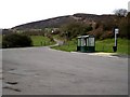
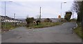
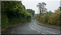
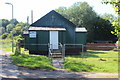
Photos of Pontymoile Community


Area Information
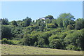
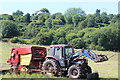
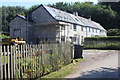
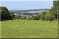
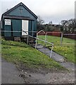
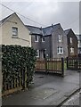
Pontymoile Community stands as a distinct civil parish within the township of Pontypool, covering an area of 8.3 square kilometres. Located directly south of Pontypool town centre, this community integrates seamlessly with neighbouring suburbs like Cwmynyscoy and Upper Race while maintaining its own identity. Historically rooted in iron production since the early 15th century, the area retains a rich industrial legacy marked by a 1575 blast furnace and the historic Monmouthshire Canal connection established in 1792. Modern developments have reshaped parts of the landscape, including the late-1990s A472 flyover that now controls access to the town. Today, you will find a mix of traditional Welsh terraced houses, early Edwardian townhouses, and post-war 1960s flats scattered across the parish. The community feels closely knit, anchored by local institutions such as St Matthew's Anglican Church and the nondenominational Pontymoile Christian Mission on Rockhill Road. While much of the housing stock connects to the broader Pontypool infrastructure, the area boasts unique local assets like the Grade II* listed Pontymoile Gates and the active Pontymoile Basin. Residents enjoy proximity to West Monmouth School and the Coleg Gwent campus, ensuring that daily life remains practical and well-connected without needing to travel far for education or community hubs.
- Area Type
- Parish
- Area Size
- 8.3 km²
- Population
- Not available
- Population Density
- Not available
Demographics
The population structure of Pontymoile Community reflects a mature age profile, with a median age of 70 years. This figure indicates that the majority of residents are senior citizens, suggesting a community dominated by retirees rather than young families or early-career professionals. Home ownership stands at 59%, a level that signifies the local authority retains a significant portion of the housing stock as social or rental properties. Consequently, the accommodation mix likely features a blend of privately owned terraced and semi-detached homes alongside larger blocks of council housing common in post-war developments. The area does not provide specific data on household composition breakdowns or ethnic diversity, meaning the precise demographic makeup beyond age and ownership percentages remains undefined in current records. Despite the absence of detailed statistics on income levels or educational attainment, the high proportion of home owners suggests a degree of financial stability within those private households. For prospective buyers, this profile indicates a quiet, established neighbourhood where long-term residents have likely settled for decades. The presence of housing built in the 1960s and earlier means maintenance costs and energy efficiency may vary significantly depending on the specific property chosen. Understanding this demographic reality is essential for anyone considering purchasing property in Pontymoile Community.
Household Size
Accommodation Type
Tenure
Ethnic Group
Religion
Household Composition
Age
Household Deprivation
NS-SEC
Explore more demographic insights in this area
Go to Demographics tabPlanning
Planning Constraints
- Flood RiskPremium
- Ramsar Wetland SitesPremium
- Area of Outstanding Natural BeautyPremium
- Protected Nature ReservePremium
- Protected WoodlandPremium
- Crime RiskPremium