Area Overview for NP44 8TY
Photos of NP44 8TY

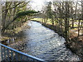
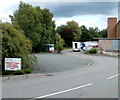
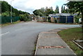
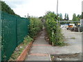
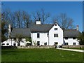
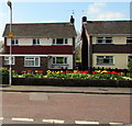
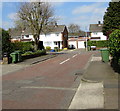
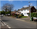
100 photos from this area
Area Information
Key information about the NP44 8TY including its size, population, and administrative classification.
- Area Type
- Postcode
- Area Size
- 4.2 hectares
- Population
- 1179
- Population Density
- 1170 people/km²
House Prices in NP44 8TY
21
Properties
£227,532
Average Sold Price
£65,000
Lowest Price
£650,000
Highest Price
Showing 21 properties
| Address | Type | Beds | Baths | Last Sale Price | Last Sale Date | |
|---|---|---|---|---|---|---|
| Greenways, Caerleon Road, Llanfrechfa, Cwmbran, NP44 8TY | house | 6 | 4 | £650,000 | Jan 2025 | |
| Tall Timbers, Caerleon Road, Llanfrechfa, Cwmbran, NP44 8TY | house | 4 | 1 | £440,000 | Apr 2022 | |
| Green Close, Caerleon Road, Llanfrechfa, Cwmbran, NP44 8TY | Semi-detached | 3 | - | £240,000 | Mar 2019 | |
| Roman Ride, Caerleon Road, Llanfrechfa, Cwmbran, NP44 8TY | Detached | 3 | - | £230,000 | Jun 2018 | |
| Breage, Caerleon Road, Llanfrechfa, Cwmbran, NP44 8TY | house | 3 | 1 | £210,000 | Aug 2017 | |
| Bower Anchors, Caerleon Road, Llanfrechfa, Cwmbran, NP44 8TY | Detached | 3 | 2 | £288,000 | Apr 2017 | |
| Caemaen, Caerleon Road, Llanfrechfa, Cwmbran, NP44 8TY | Semi-detached | 3 | - | £195,000 | Jan 2016 | |
| Sunnyways, Caerleon Road, Llanfrechfa, Cwmbran, NP44 8TY | Detached | - | - | £249,500 | Oct 2006 | |
| Maori, Caerleon Road, Llanfrechfa, Cwmbran, NP44 8TY | Detached | - | - | £170,000 | Sep 2003 | |
| Moyana, Caerleon Road, Llanfrechfa, Cwmbran, NP44 8TY | Detached | - | - | £125,000 | Dec 2002 |
Page 1 of 3
Energy Efficiency in NP44 8TY
Amenities
Schools
| Rank | School | Type | Entry gender | Ages |
|---|
Explore more schools in this area
Go to Schools tabDemographics
Household Size
Two person
most common
Accommodation Type
Houses
most common
Tenure
82
majority
Ethnic Group
White
most common
Religion
N/A
most common
Household Composition
N/A
most common
Age
47
median
Adults (30-64 years)
most common
Household Deprivation
N/A
with no deprivation
NS-SEC
41
in Lower managerial occupations
Explore more demographic insights in this area
Go to Demographics tabPlanning
Planning Constraints
- Flood RiskPremium
- Ramsar Wetland SitesPremium
- Area of Outstanding Natural BeautyPremium
- Protected Nature ReservePremium
- Protected WoodlandPremium
- Crime RiskPremium