Area Overview for NP44 8AD
Photos of NP44 8AD
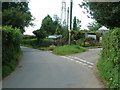

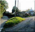
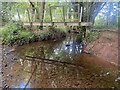
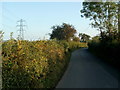
5 photos from this area
Area Information
Key information about the NP44 8AD including its size, population, and administrative classification.
- Area Type
- Postcode
- Area Size
- 1.5 km²
- Population
- 1380
- Population Density
- 402 people/km²
House Prices in NP44 8AD
13
Properties
£720,000
Average Sold Price
£300,000
Lowest Price
£945,000
Highest Price
Showing 13 properties
| Address | Type | Beds | Baths | Last Sale Price | Last Sale Date | |
|---|---|---|---|---|---|---|
| Ty Llwyd Farm, Church Road, Llanfrechfa, Cwmbran, NP44 8AD | Detached | 5 | 2 | £945,000 | Dec 2023 | |
| Southgate, Church Road, Llanfrechfa, Cwmbran, NP44 8AD | Bungalow | - | - | £300,000 | Sep 2014 | |
| Ty Carreg, Church Road, Llanfrechfa, Cwmbran, NP44 8AD | house | - | - | £915,000 | Aug 2011 | |
| Pantyreos Farm, Church Road, Llanfrechfa, Cwmbran, NP44 8AD | Semi-detached | - | - | - | - | |
| Ehsan Lodge, Church Road, Llanfrechfa, Cwmbran, NP44 8AD | Bungalow | - | - | - | - | |
| Berthllwyd Farm, Church Road, Llanfrechfa, Cwmbran, NP44 8AD | Detached | - | - | - | - | |
| Llysbrechfa House, Church Road, Llanfrechfa, Cwmbran, NP44 8AD | Detached | - | - | - | - | |
| Gate House, Church Road, Llanfrechfa, Cwmbran, NP44 8AD | Detached | - | - | - | - | |
| Sunfield, Church Road, Llanfrechfa, Cwmbran, NP44 8AD | Detached | - | - | - | - | |
| Glan Sirhowy Farm, Church Road, Llanfrechfa, Cwmbran, NP44 8AD | Detached | - | - | - | - |
Page 1 of 2
Energy Efficiency in NP44 8AD
Amenities
Schools
| Rank | School | Type | Entry gender | Ages |
|---|
Explore more schools in this area
Go to Schools tabDemographics
Household Size
Two person
most common
Accommodation Type
Houses
most common
Tenure
91
majority
Ethnic Group
White
most common
Religion
N/A
most common
Household Composition
N/A
most common
Age
47
median
Adults (30-64 years)
most common
Household Deprivation
N/A
with no deprivation
NS-SEC
49
in Lower managerial occupations
Explore more demographic insights in this area
Go to Demographics tabPlanning
Planning Constraints
- Flood RiskPremium
- Ramsar Wetland SitesPremium
- Area of Outstanding Natural BeautyPremium
- Protected Nature ReservePremium
- Protected WoodlandPremium
- Crime RiskPremium