Area Overview for NP44 6UA
Photos of NP44 6UA
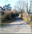
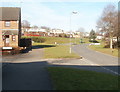
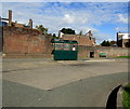
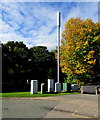


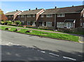
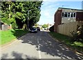
100 photos from this area
Area Information
Key information about the NP44 6UA including its size, population, and administrative classification.
- Area Type
- Postcode
- Area Size
- 1.7 hectares
- Population
- 2438
- Population Density
- 3278 people/km²
House Prices in NP44 6UA
25
Properties
£101,623
Average Sold Price
£36,000
Lowest Price
£170,000
Highest Price
Showing 25 properties
| Address | Type | Beds | Baths | Last Sale Price | Last Sale Date | |
|---|---|---|---|---|---|---|
| 80 Farlays, Coed Eva, Cwmbran, NP44 6UA | house | - | - | £170,000 | Jul 2022 | |
| 78 Farlays, Coed Eva, Cwmbran, NP44 6UA | Terraced | 3 | 1 | £155,000 | May 2022 | |
| 65 Farlays, Coed Eva, Cwmbran, NP44 6UA | house | - | - | £135,000 | Jul 2021 | |
| 71 Farlays, Coed Eva, Cwmbran, NP44 6UA | house | - | - | £142,000 | Jun 2021 | |
| 87 Farlays, Coed Eva, Cwmbran, NP44 6UA | Terraced | 3 | 1 | £137,000 | Jul 2019 | |
| 72 Farlays, Coed Eva, Cwmbran, NP44 6UA | Terraced | 4 | 1 | £140,000 | Jan 2019 | |
| 83 Farlays, Coed Eva, Cwmbran, NP44 6UA | Terraced | 2 | - | £88,500 | Nov 2017 | |
| 89 Farlays, Coed Eva, Cwmbran, NP44 6UA | Semi-detached | 3 | - | £82,500 | Jun 2014 | |
| 86 Farlays, Coed Eva, Cwmbran, NP44 6UA | house | - | - | £97,000 | Dec 2009 | |
| 88 Farlays, Coed Eva, Cwmbran, NP44 6UA | Semi-detached | - | - | £57,500 | Oct 2002 |
Page 1 of 3
Energy Efficiency in NP44 6UA
Amenities
Schools
| Rank | School | Type | Entry gender | Ages |
|---|
Explore more schools in this area
Go to Schools tabDemographics
Household Size
Family (3-5 people)
most common
Accommodation Type
Houses
most common
Tenure
74
majority
Ethnic Group
White
most common
Religion
N/A
most common
Household Composition
N/A
most common
Age
47
median
Adults (30-64 years)
most common
Household Deprivation
N/A
with no deprivation
NS-SEC
32
in Lower managerial occupations
Explore more demographic insights in this area
Go to Demographics tabPlanning
Planning Constraints
- Flood RiskPremium
- Ramsar Wetland SitesPremium
- Area of Outstanding Natural BeautyPremium
- Protected Nature ReservePremium
- Protected WoodlandPremium
- Crime RiskPremium