Area Overview for NP44 6LE
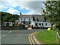
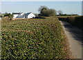
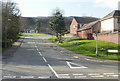
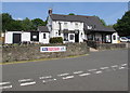
Photos of NP44 6LE


Area Information
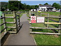
Living in NP44 6LE offers peace within a distinctly Welsh residential cluster. This specific postcode covers a small footprint of 3,713 square metres yet supports a population of 1,499 people. The density here stands at 146 people per square kilometre, creating a setting that feels settled and manageable rather than chaotic. You will find a compact community where daily life revolves around established local routines and familiar surroundings. The area functions as a quiet residential hub, balancing privacy with reasonable access to nearby services. Residents appreciate the predictable nature of life in this postcode sector. The tight-knit feel comes from the limited physical space and the cohesive demographic makeup. It is a place where neighbours often know one another, fostering a sense of mutual reliance without the stress of high-density living. The landscape supports a calm existence, away from the frantic pace of larger towns. For those considering homes in NP44 6LE, the environment feels intimate and grounded. The small area serves as a contained neighbourhood where boundaries are clear and the community is defined by its residential purpose. You move here if you value a stable, low-pressure atmosphere. The area includes a mix of housing types suited to families and individuals seeking a break from city noise. Daily existence here is structured around practicality and the安稳 of a known local world.
- Area Type
- Postcode
- Area Size
- 3713 m²
- Population
- 1499
- Population Density
- 146 people/km²
Homes in NP44 6LE are characterised by a strong tradition of private ownership. With an ownership rate of 87%, the market is overwhelmingly driven by people who have bought their properties to keep. This high percentage implies that supply consists mainly of existing stock rather than new development or rental conversions. Buyers looking at this area need to compete with a large pool of motivated sellers who feel attached to their current homes. The accommodation type is exclusively Houses. You will find terraced, semi-detached, or detached dwellings rather than apartments or flats. This style of housing suits the older demographic with their preference for gardens and traditional living spaces. The lack of multi-storey apartments means vertical space is not a consideration here. Each property stands with distinct identity. For those selling, the high ownership rate suggests a familiar selling process among neighbours. However, the concentration of owners means you may face stiff competition if you list your home. The market is not a landlord-dominated landscape; it is a community of residents who have put down roots. This stability can provide security but may also limit the speed of turnover compared to areas with high rental mobility.
House Prices in NP44 6LE
Showing 18 properties
| Address | Type | Beds | Baths | Last Sale Price | Last Sale Date | |
|---|---|---|---|---|---|---|
| 11 Bryn Henllys View, Henllys, Cwmbran, NP44 6LE | Flat | - | - | £133,000 | Feb 2024 | |
| 5 Bryn Henllys View, Henllys, Cwmbran, NP44 6LE | Terraced | 2 | 1 | £89,000 | Oct 2022 | |
| 10 Bryn Henllys View, Henllys, Cwmbran, NP44 6LE | Flat | - | - | £125,000 | Jun 2021 | |
| 9 Bryn Henllys View, Henllys, Cwmbran, NP44 6LE | Flat | - | - | £120,000 | Dec 2020 | |
| 2 Bryn Henllys View, Henllys, Cwmbran, NP44 6LE | house | - | - | £159,950 | Nov 2020 | |
| 6 Bryn Henllys View, Henllys, Cwmbran, NP44 6LE | house | - | - | £58,000 | Sep 2020 | |
| 4 Bryn Henllys View, Henllys, Cwmbran, NP44 6LE | Terraced | 2 | - | £73,000 | Jul 2020 | |
| 12 Bryn Henllys View, Henllys, Cwmbran, NP44 6LE | Flat | - | - | £115,000 | Feb 2020 | |
| 7 Bryn Henllys View, Henllys, Cwmbran, NP44 6LE | Flat | - | - | £97,390 | Dec 2016 | |
| 3 Bryn Henllys View, Henllys, Cwmbran, NP44 6LE | Terraced | 2 | 2 | £124,175 | Jun 2016 |
Energy Efficiency in NP44 6LE
Daily life in NP44 6LE benefits from a network of amenities that are practically within reach. Three major supermarkets anchor the retail scene, offering convenience for weekly food shops and household staples. Residents rely on Tesco Cwmbran, Spar, and Asda Cwmbran for their primary grocery needs. These large stores provide a one-stop shop for everything from fresh produce to laundry supplies. Public transport hubs facilitate easy access to broader regions. You can reach Cwmbran Railway Station, Risca and Pontymister Railway Station, or Rogerstone Railway Station for daily commutes. These five accessible rail points ensure you are not cut off from the rest of Wales. The proximity of these stations adds a layer of mobility to the otherwise quiet residential setting. Smaller retail options like local Spar shops fill gaps between major supermarkets. They provide essential items without the need to travel far. The presence of five notable retail locations means you rarely need to venture outside the postcode area for basic needs. This concentration of services reduces travel time and parking frustration.
Amenities
Schools
| Rank | School | Type | Entry gender | Ages |
|---|
Explore more schools in this area
Go to Schools tabDemographics
The community in NP44 6LE is defined by stability and maturity. The median age is 47, meaning the population skews towards middle and older adulthood. Adults between the ages of 30 and 64 years form the most common age range, indicating a group with established careers and families. This age profile suggests a neighbourhood where residents have deep roots and long-term plans. Home ownership is exceptionally high at 87%. This figure signals that the vast majority of households are independent and financially secure in their local ties. Low rental prevalence means the property market reflects long-term ownership rather than transient tenancies. Most residents are likely looking to stay for decades. The architectural landscape is dominated by Houses, which aligns perfectly with the demographic and ownership data. Predominantly White residents make up the majority of the ethnic group, contributing to a culturally uniform and homogeneous environment. You will not find the rapid demographic shifts common in student cities. Instead, the social fabric is woven from shared history and common life stages. This consistency creates a predictable and supportive social environment for children and families alike.
Household Size
Accommodation Type
Tenure
Ethnic Group
Religion
Household Composition
Age
Household Deprivation
NS-SEC
Explore more demographic insights in this area
Go to Demographics tabPlanning
Planning Constraints
- Flood RiskPremium
- Ramsar Wetland SitesPremium
- Area of Outstanding Natural BeautyPremium
- Protected Nature ReservePremium
- Protected WoodlandPremium
- Crime RiskPremium