Area Overview for NP44 3FT
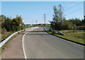
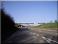
Photos of NP44 3FT


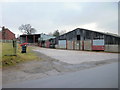
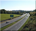
![Llantarnam Bypass A4042 [1] in NP44 3FT](https://images.propbar.co.uk/images/geograph/11/89/1189263_120.jpg)
![Llantarnam Bypass A4042 [2] in NP44 3FT](https://images.propbar.co.uk/images/geograph/11/89/1189267_120.jpg)

Area Information
Living in NP44 3FT means residing within a specific residential cluster defined by the postcode NP44 3FT. This neighbourhood occupies 4.0 hectares in Wales and accommodates a population of 2652 people. You will find a community that is dense enough to feel lively but compact enough to maintain a focused local identity. The concentration of residents results in a density of 482 people per square kilometre, which suggests a neighbourhood where neighbours are likely within casual sight and sound of one another. Daily life in NP44 3FT is characterised by a close-knit environment where the residential cluster serves as a central hub for local interaction. The area is distinctly Welsh, situated in a region known for its blend of rural charm and accessible town centres. With 2652 residents sharing this limited space, the community likely operates with a strong sense of locality. The postcode itself acts as the primary identifier for this small but significant residential pocket. Homebuyers considering NP44 3FT are looking at an environment where urban convenience meets intimate scale. The area does not sprawl; rather, it concentrates its population into a manageable footprint. This makes it suitable for those who prefer a walkable existence without the congestion of a large city metropolis. The specific boundaries of NP44 3FT create a defined sense of place that separates residents from the wider regions of Monmouthshire and Newport. You gain access to a community that is substantial in numbers yet confined within clear spatial limits, fostering a residential atmosphere that is both personal and connected.
- Area Type
- Postcode
- Area Size
- 4.0 hectares
- Population
- 2652
- Population Density
- 482 people/km²
The property market in NP44 3FT is heavily oriented towards owner-occupiers, with 79% of the population holding the freehold to their residences. This statistic transforms the area from a potential rental hotspot into a settled neighbourhood where most houses have been purchased and held for extended periods. The accommodation type is exclusively houses, meaning you will find a landscape of terraced, semi-detached, or detached family dwellings rather than blocks of flats or bungalows concentrated in high-density social housing. Buying homes in NP44 3FT appeals to individuals seeking a traditional neighbourhood rather than a high-rise city living arrangement. The high ownership percentage indicates that buyers have already entered the market and secured their properties, suggesting that available stock for sale may be limited to move-up purchases or family downsizing. This dynamic can create a competitive local market where sellers hold their assets firmly. Prospective buyers should approach this area expecting a stock that is firmly rooted in primary ownership. Rental opportunities in this postcode are likely scarce compared to other urban districts because the owner-occupation rate is so high. If you are looking for a tenanted property, the search in NP44 3FT might require looking to the slightly wider NP44 or NP10 boundaries where rental demand is more common. The house-focused accommodation type means that families requiring specific spaces, such as gardens and larger square footage, will find they are in a zone designed for that purpose. The 79% ownership figure is a key indicator that this community values permanence and personal investment in their property, distinct from the transient nature of rental markets.
House Prices in NP44 3FT
Showing 22 properties
| Address | Type | Beds | Baths | Last Sale Price | Last Sale Date | |
|---|---|---|---|---|---|---|
| 12 Malthouse Close, Llantarnam, Cwmbran, NP44 3FT | Flat | - | - | - | - | |
| 13 Malthouse Close, Llantarnam, Cwmbran, NP44 3FT | Flat | - | - | - | - | |
| 21 Malthouse Close, Llantarnam, Cwmbran, NP44 3FT | house | - | - | - | - | |
| 22 Malthouse Close, Llantarnam, Cwmbran, NP44 3FT | house | - | - | - | - | |
| 5 Malthouse Close, Llantarnam, Cwmbran, NP44 3FT | house | - | - | - | - | |
| 1 Malthouse Close, Llantarnam, Cwmbran, NP44 3FT | house | - | - | - | - | |
| 17 Malthouse Close, Llantarnam, Cwmbran, NP44 3FT | house | - | - | - | - | |
| 19 Malthouse Close, Llantarnam, Cwmbran, NP44 3FT | house | - | - | - | - | |
| 8 Malthouse Close, Llantarnam, Cwmbran, NP44 3FT | house | - | - | - | - | |
| 10 Malthouse Close, Llantarnam, Cwmbran, NP44 3FT | house | - | - | - | - |
Energy Efficiency in NP44 3FT
Lifestyle in NP44 3FT centres on accessibility to a range of amenities located just outside the immediate postcode boundary. Residents benefit from the presence of five retail venues within practical reach, including M&S Malpas BP, Spar, and Tesco Newport. These supermarkets provide comprehensive daily requirements for food and household essentials, ensuring that you do not need to travel far for groceries. The availability of a Spar and M&M indicates a range of convenience options alongside larger hypermarket facilities. Transport connectivity is a major highlight of the lifestyle profile, with five railway stations serving the wider area. Cwmbran Railway Station, Newport Railway Station, and Rogerstone Railway Station provide frequent links to Cardiff and London. This rail access means that commuting into major employment centres is a manageable task, effectively bridging the gap between rural living and urban opportunity. For residents of NP44 3FT, the railway network transforms the postcode into a commuter-friendly zone without sacrificing local tranquility. Leisure options are present through Newport Ferry Terminal, which offers one ferry service within the reachable amenity sphere. While not a destination in itself, the ferry terminal provides residents with access to broader regional travel, including potential excursions to Anglesey or South Wales. The combination of five retail sites, five rail stations, and one ferry terminal creates a diversified lifestyle palette. You gain the convenience of local shopping, the speed of rail travel, and the possibility of coastal exploration, all while living within the specific boundaries of NP44 3FT.
Amenities
Schools
Schools near NP44 3FT provide educational options primarily situated outside the immediate postal boundary but within practical reach for residents. Llantarnam School stands as one of the key educational institutions serving the broader NRNP region, offering schooling that supports the local catchment area. Rougemont School is another notable institution, contributing to the educational landscape accessible to families in the postcode. Both institutions are listed as "other" types in the current data, meaning they do not strictly fit the standard primary or secondary classifications used in many other reports. This classification may indicate special needs provision, a religious school, or a staged education campus. Owing to this categorisation, it is difficult to assign a standard Ofsted rating to these specific entries in the provided information. Families considering NP44 3FT must verify the specific curriculum and inspection ratings directly through the schools or the local council, as the data label is broad. The presence of these two institutions suggests that the area has access to more than just a single educational choice. Residents of NP44 3FT benefit from being close to multiple facilities, which offers flexibility even if the specific educational stages are not detailed in the summary record. For parents evaluating homes in NP44 3FT, the proximity to Llantarnam School and Rougemont School is a significant practical advantage, reducing travel time from NP44 3FT to the classroom. The variety of school options ensures that families do not need to travel vast distances for education, even amidst the specific categorisation of the available schools.
| Rank | School | Type | Entry gender | Ages |
|---|
Explore more schools in this area
Go to Schools tabDemographics
The community in NP44 3FT is defined by a mature demographic profile centred entirely on adults. The median age stands at 47, indicating that the majority of residents fall into the 30 to 64 years age range. This suggests a population that has established careers and familial roots rather than a transient student or youthful workforce. You will predominantly encounter long-term residents who have settled within this postcode boundary over time. House ownership is a defining feature of the area, with 79% of the population owning their homes. This significantly higher rate of ownership compared to national averages implies a stable community where families stay put rather than cycling through short-term tenancies. The accommodation type in NP44 3FT consists primarily of houses, reinforcing the family-oriented nature of the cluster. The ethnic composition is predominantly White, which aligns with the broader demographic trends of rural Wales and the surrounding Monmouthshire region. Deprivation and social mobility are not explicitly quantified in the current data, but the high ownership rate offers a clear indicator of economic stability within the neighbourhood. The age structure means that local services and community groups likely cater to adults seeking usability rather than youth entertainment. Residents in NP44 3FT benefit from a homogenous social fabric where most neighbours share similar life stages, such as managing adult children or preparing for retirement. This demographic consistency often leads to a quieter, more predictable community atmosphere compared to districts with a younger population. The 30 to 64 years bracket dominates the age distribution, creating a social environment focused on stability and continuity.
Household Size
Accommodation Type
Tenure
Ethnic Group
Religion
Household Composition
Age
Household Deprivation
NS-SEC
Explore more demographic insights in this area
Go to Demographics tabPlanning
Planning Constraints
- Flood RiskPremium
- Ramsar Wetland SitesPremium
- Area of Outstanding Natural BeautyPremium
- Protected Nature ReservePremium
- Protected WoodlandPremium
- Crime RiskPremium