Area Overview for NP44 3FS
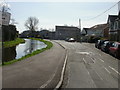
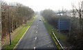
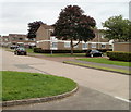
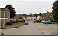
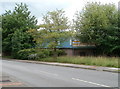
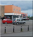
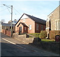
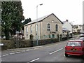
Photos of NP44 3FS


Area Information
Living in NP44 3FS offers a compact residential experience within a specific postcode cluster in Wales. You are situated in an area covering just 2.7 hectares, where life is defined by proximity rather than sprawl. Over 2,300 people call this small cluster home, creating a tight community atmosphere. The high population density of 2,205 people per square kilometre means streets are populated, offering a sense of bustling activity without the isolation found in larger towns. This area serves as a focused residential zone for those seeking convenience within a defined boundary. You will find a concentrated neighbourhood where daily needs are often steps away. The layout supports a lifestyle centred on local interaction, making it an intense yet manageable environment for families or individuals. Residents here benefit from a clear identity, knowing they reside in one of Cwmbran's distinct postcode sectors. The small geographical footprint ensures that neighbours are likely to be known, fostering a strong local bond. For someone looking at Wales for a property search, this postcode represents a specific, accessible patch of the residential landscape. It is a place defined by its size and the immediate community it houses.
- Area Type
- Postcode
- Area Size
- 2.7 hectares
- Population
- 2323
- Population Density
- 2205 people/km²
The property market in NP44 3FS is characterised by its small scale and specific housing stock. Because the value type is exclusively houses, you will not find flats or apartments for sale in this specific postcode. The high home ownership rate of 65% indicates that the local housing market is dominated by residents living in their own properties. This structure often means houses are sold to new owners or inherited rather than turning over in the private rental sector. You are looking at a market where houses are the primary asset for sale, catering to buyers seeking single-family homes. The compact size of the area, at just 2.7 hectares, limits the total number of properties available, which can influence competition among buyers. When considering homes in NP44 3FS, you are entering a focused market where inventory is limited. The necessity of houses as the main accommodation type means you must fit your lifestyle around this specific building style. Buyers here often find a neighbourhood designed for ownership, reducing the likelihood of tenant turnover. This stability affects property values and the overall pace of change in the local housing landscape.
House Prices in NP44 3FS
No properties found in this postcode.
Energy Efficiency in NP44 3FS
Daily life in NP44 3FS is shaped by a variety of amenities within practical reach. For shopping needs, you have three major retail options: Asda Cwmbran, Iceland Cwmbran, and Spar. These supermarkets provide comprehensive grocery and household goods supplies. For travel beyond the local cluster, there are five railway stations nearby, including Cwmbran Railway Station, Pontypool & New Inn Railway Station, and Newport Railway Station. The presence of a ferry at Newport Ferry Terminal offers additional transport variety, though the train stations are the primary options for regional travel. This mix of retail and transport hubs ensures that residents can access goods and commute efficiently. You can run errands at Asda Cwmbran or travel to the wider region via the rail network. The available amenities create a practical lifestyle where daily requirements are met without extensive travel. The proximity to these services means that the 2.7-hectare residential area is well-linked to the broader infrastructure of Wales. You benefit from the convenience of local stores and the connectivity of major transport nodes.
Amenities
Schools
Families living in NP44 3FS have access to specific educational facilities nearby. The primary educational provision within reach is Llantarnam Community Primary School. This institution serves as the key local school option for children in the immediate vicinity. Schools near NP44 3FS are limited in number, reflecting the residential nature of this small postcode cluster. As a primary school, Llantarnam Community Primary School caters to younger children, ensuring that early education is accessible. You must plan ahead regarding secondary school options as no secondary institutions are listed for this specific postcode. The type of school available, a community primary, implies a local catchment focus for elementary education. Parents in the area rely on this single named facility for the primary phase of schooling. While Llantarnam Community Primary School provides a foundation, families will need to consider other schools outside this specific cluster for older children. This simplicity in school data highlights the close-knit nature of the local community and its educational infrastructure.
| Rank | School | Type | Entry gender | Ages |
|---|
Explore more schools in this area
Go to Schools tabDemographics
The community in NP44 3FS has a distinctly mature character, with a median age of 47 years. The most common age range consists of adults between 30 and 64 years old, indicating a population settled in their prime working or semi-retirement years. A significant majority of residents, at 65%, own their homes, suggesting a stable resident base rather than a fluid rental market. The accommodation type in this area is predominantly houses, which aligns with the demographic profile of established families and long-term owners. You will find a homogenous population regarding ethnicity, with the white group being the predominant demographic. This statistical picture paints a clear image of a neighbourhood built by and for established households. The high home ownership rate means that selling a property here may involve negotiating with an owner-occupier. The age profile suggests a quiet, settled environment where families have likely been raised locally. Services are tailored to the needs of this adult demographic, from local shops to leisure facilities. Understanding these figures helps you grasp the rhythm of daily life in NP44 3FS.
Household Size
Accommodation Type
Tenure
Ethnic Group
Religion
Household Composition
Age
Household Deprivation
NS-SEC
Explore more demographic insights in this area
Go to Demographics tabPlanning
Planning Constraints
- Flood RiskPremium
- Ramsar Wetland SitesPremium
- Area of Outstanding Natural BeautyPremium
- Protected Nature ReservePremium
- Protected WoodlandPremium
- Crime RiskPremium