Area Overview for NP44 2LF
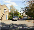
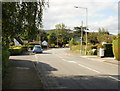
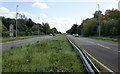
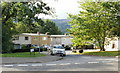
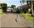
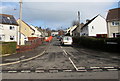
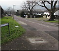
Photos of NP44 2LF

Area Information
Living in NP44 2LF offers a tranquil residential experience within a very small cluster. This postcode covers just 1.6 hectares, yet it supports a population of 1,793 people. The resulting density of 1,664 people per square kilometre ensures a compact community where neighbours are accessible without the noise of a sprawling city centre. You will find this area serves as a dense residential pocket for families and individuals seeking a settled life. The location is situated clearly in Wales, providing a distinct regional background to your daily routine. Unlike scattered developments, the concentrated nature of NP44 2LF means services and neighbours are within immediate reach. The area functions as a self-contained neighbourhood where local life revolves around the immediate vicinity. Residents enjoy the benefits of proximity while maintaining a close-knit environment. This setting is ideal for those who prefer a defined boundary for their home life over vast open spaces or sprawling suburbs. The physical size of the area reinforces a sense of locality and mutual awareness among the population.
- Area Type
- Postcode
- Area Size
- 1.6 hectares
- Population
- 1793
- Population Density
- 1664 people/km²
Looking at the property market in NP44 2LF, you are entering an area defined by established homeownership. With 74% of properties owned outright or with a mortgage, the area is not dominated by private landlords. This statistic suggests a stable housing stock where changes occur gradually rather than through rapid turnover. The accommodation type is strictly houses, so you will not find any flats or apartments available in this specific postcode. Buyers looking for homes in NP44 2LF are restricted to detached or semi-detached properties depending on the specific layout of the 1.6-hectare site. This uniformity in property type appeals to those seeking traditional family homes rather than urban living. The high ownership rate often correlates with areas where parents have stayed for years to raise children. If you are considering purchasing, expect a market with stable owners who value their residences. The absence of rental sectors or mixed-use developments keeps the character consistent. This focus on houses and owner-occupiers means the area resists the volatility seen in high-rent zones. Your search will yield a consistent standard of residential living.
House Prices in NP44 2LF
Showing 27 properties
| Address | Type | Beds | Baths | Last Sale Price | Last Sale Date | |
|---|---|---|---|---|---|---|
| 95 Bryn Eglwys, Croesyceiliog, Cwmbran, NP44 2LF | house | - | - | £328,000 | Mar 2021 | |
| 69 Bryn Eglwys, Croesyceiliog, Cwmbran, NP44 2LF | house | - | - | £185,000 | Aug 2017 | |
| 66 Bryn Eglwys, Croesyceiliog, Cwmbran, NP44 2LF | Flat | 2 | 1 | £100,000 | May 2017 | |
| 75 Bryn Eglwys, Croesyceiliog, Cwmbran, NP44 2LF | Semi-detached | 3 | - | £144,000 | Aug 2015 | |
| 91 Bryn Eglwys, Croesyceiliog, Cwmbran, NP44 2LF | Detached | - | - | £150,000 | Mar 2013 | |
| 71 Bryn Eglwys, Croesyceiliog, Cwmbran, NP44 2LF | Semi-detached | - | - | £125,000 | Apr 2012 | |
| 81 Bryn Eglwys, Croesyceiliog, Cwmbran, NP44 2LF | Semi-detached | - | - | £145,000 | Oct 2008 | |
| 77 Bryn Eglwys, Croesyceiliog, Cwmbran, NP44 2LF | Semi-detached | - | - | £72,000 | Apr 2001 | |
| 67 Bryn Eglwys, Croesyceiliog, Cwmbran, NP44 2LF | house | - | - | £79,950 | Feb 2001 | |
| 79 Bryn Eglwys, Croesyceiliog, Cwmbran, NP44 2LF | Semi-detached | - | - | £56,000 | Oct 1999 |
Energy Efficiency in NP44 2LF
Residents of NP44 2LF benefit from a well-provided retail and transport corridor nearby. Five retail outlets serve the local demand, including Co-op Cwmbran, Morrisons Cwmbran, and Heron Cwmbran. These shops offer daily essentials and groceries within practical reach, removing the need for long journeys to larger cities. For commuters, five rail stations provide excellent connectivity, specifically Cwmbran Railway Station, Pontypool & New Inn Railway Station, and Newport Railway Station. These stations allow you to access major hubs and travel networks without using your car every day. The mix of local shops and national rail stations creates a balanced lifestyle. You can buy fresh food close to home while retaining the freedom to travel by train. The area caters to both casual shoppers and serious commuters. This combination ensures convenience for weekends and efficiency for workdays. Your daily routine is supported by these key venues.
Amenities
Schools
Education options for residents of NP44 2LF prioritise local access to established institutions. The nearest school listed for the area is Croesyceiliog School, which serves as the primary educational facility for children in the vicinity. This school is designated as another type of institution, providing flexibility in its educational offering. While specific Ofsted ratings are not included in the current data, the presence of established schools indicates a commitment to local education. For families living in NP44 2LF, this is the first point of contact for young learners. The school type classification suggests a comprehensive approach to education rather than a specialist nurseries or academies only. Parents in this neighbourhood rely on this single named provider for their children's primary schooling needs. The distance to Croesyceiliog School is practical given the small footprint of the postcode area. This proximity ensures that daily travel to school is manageable for families. You have direct access to formal education structures without needing to travel far outside the immediate area.
| Rank | School | Type | Entry gender | Ages |
|---|
Explore more schools in this area
Go to Schools tabDemographics
The community in NP44 2LF reflects a mature population with a median age of 47 years. Most residents fall within the adult age range of 30 to 64 years, indicating an established demographic rather than a young starter market. Home ownership stands at an impressive 74%, showing that the vast majority of people have purchased their properties. This high level of ownership creates a stable environment where long-term residents remain in the area. The accommodation type is exclusively houses, meaning there are no flats or apartments to choose from in this specific cluster. The predominant ethnic group is White, which mirrors the broader national composition of the region. These figures paint a picture of a settled, family-oriented neighbourhood where homeowners have taken root. The age profile suggests quiet streets rather than a bustling youth scene. You can expect an area where residents have invested time and effort into building their homes. The lack of young adults or retirees in significant numbers shapes the social dynamics, focusing on the needs of the primary working and post-working age groups.
Household Size
Accommodation Type
Tenure
Ethnic Group
Religion
Household Composition
Age
Household Deprivation
NS-SEC
Explore more demographic insights in this area
Go to Demographics tabPlanning
Planning Constraints
- Flood RiskPremium
- Ramsar Wetland SitesPremium
- Area of Outstanding Natural BeautyPremium
- Protected Nature ReservePremium
- Protected WoodlandPremium
- Crime RiskPremium