Area Overview for NP44 2EG
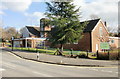
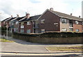
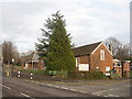
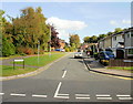
Photos of NP44 2EG


Area Information
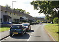
Living in NP44 2EG means residing within a compact residential cluster defined by postcode NP44 2EG in western Wales. The area covers just 1.1 hectares and is home to 1,793 people, resulting in a population density of 1,664 people per square kilometre. This high density suggests a situated neighbourhood rather than a sprawling district, where daily life occurs close to home. The location sits within the broader administrative boundaries of Wales but functions as a distinct micro-community with close-knight interactions. Residents benefit from being part of a concentrated group where everyone knows their neighbours. This specific postcode area offers a sense of locality without the isolation of remote rural living. The small footprint means everything is within walking distance or a short drive away from your doorstep. You are in a zone where space is premium and community is practical. The environment feels lived-in and established, reflecting decades of settlement in this specific corner of the region.
- Area Type
- Postcode
- Area Size
- 1.1 hectares
- Population
- 1793
- Population Density
- 1664 people/km²
The property market in NP44 2EG is dominated by owner-occupied housing, with statistics showing that 74% of the population owns their home outright or with a mortgage. This high ownership percentage signals a mature market where families have invested in their properties over time. The primary accommodation type is houses, meaning you will find detached, semi-detached, or terraced properties rather than high-rise apartments or converted lofts. Because the area is a small postcode covering only 1.1 hectares, the housing stock is limited and specialised for local needs. Buyers looking for flats in a traditional urban high-rise setting will not find them here. Instead, the market caters to those seeking houses with gardens or driveway access in a low-density setting relative to the city centre. The concentration of ownership suggests prices may be stable, driven by local demand from people who have chosen to settle down. Rental properties exist but do not define the character of the street.
House Prices in NP44 2EG
Showing 35 properties
| Address | Type | Beds | Baths | Last Sale Price | Last Sale Date | |
|---|---|---|---|---|---|---|
| 30 Poplar Road, Croesyceiliog, Cwmbran, NP44 2EG | Terraced | 3 | 1 | £210,000 | Aug 2025 | |
| 17 Poplar Road, Croesyceiliog, Cwmbran, NP44 2EG | Terraced | 3 | 1 | £175,000 | Feb 2025 | |
| 21 Poplar Road, Croesyceiliog, Cwmbran, NP44 2EG | Terraced | 3 | 1 | £185,000 | Jan 2024 | |
| 19 Poplar Road, Croesyceiliog, Cwmbran, NP44 2EG | house | - | - | £180,000 | Apr 2023 | |
| 11 Poplar Road, Croesyceiliog, Cwmbran, NP44 2EG | Terraced | 3 | - | £145,000 | Jul 2018 | |
| 15 Poplar Road, Croesyceiliog, Cwmbran, NP44 2EG | Terraced | 3 | - | £140,000 | Jun 2018 | |
| 35 Poplar Road, Croesyceiliog, Cwmbran, NP44 2EG | house | 3 | 1 | £124,000 | Mar 2018 | |
| 1 Poplar Road, Croesyceiliog, Cwmbran, NP44 2EG | Terraced | 3 | 1 | £134,950 | Jan 2018 | |
| 29 Poplar Road, Croesyceiliog, Cwmbran, NP44 2EG | house | - | - | £132,000 | Dec 2017 | |
| 31 Poplar Road, Croesyceiliog, Cwmbran, NP44 2EG | house | - | - | £149,950 | Jun 2015 |
Energy Efficiency in NP44 2EG
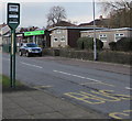
Daily life in NP44 2EG blends local convenience with access to major Retail and transport hubs nearby. Within practical reach, you find five retail outlets including Co-op Cwmbran, Morrisons Cwmbran, and Heron Cwmbran. These supermarkets allow you to stock your fridge and pantry without travelling far. Beyond groceries, rail transport offers five stations within easy commuting distance. Cwmbran Railway Station serves as the nearest major hub, with Pontypool & New Inn Railway Station and Newport Railway Station also located nearby. This rail connectivity links you to the wider network, allowing quick access to Cardiff, Newport, and beyond. You do not need a car for every journey, thanks to these frequent train services. Your lifestyle includes the ability to shop at Heron Cwmbran or Co-op Cwmbran on a Sunday morning, then head to Newport by train later in the day. The area balances village-level convenience with city-level reach.
Amenities
Schools
Families considering NP44 2EG should note that Croesyceiliog School is the nearest educational institution listed in this postcode area. The school is classified as an "other" type, which typically denotes a college, sixth form, or special provision rather than a primary or secondary house. This classification means the immediate vicinity supports older students or alternative education needs rather than young children attending primary schools directly across the road. While primary education options may lie slightly further away, Croesyceiliog School provides a local option for post-primary education. For parents, this indicates a need to check catchment zones for younger children beyond the immediate postcode boundary. The presence of this specific school confirms that the surrounding area supports educational infrastructure, even if it does not contain a traditional primary academy within the 1.1-hectare footprint of NP44 2EG itself.
| Rank | School | Type | Entry gender | Ages |
|---|
Explore more schools in this area
Go to Schools tabDemographics
The community in NP44 2EG is characterised by a mature population with a median age of 47 years. Most residents fall into the adult age range between 30 and 64 years old, indicating a stable demographic with established careers and families. This age profile suggests a neighbourhood where households are likely to have children or be empty-nesters seeking tranquility. Home ownership stands at 74%, meaning the vast majority of residents buy their own homes rather than rent. The prevailing form of accommodation consists of houses, which aligns with the high ownership rate and mature age profile. The predominant ethnic group is White, creating a culturally consistent environment typical of the region. There is a clear sense of long-term settlement here, as opposed to a transient or student-heavy area. Families have likely remained in their homes for many years, fostering strong local ties. The demographic data paints a picture of a settled, middle-to-upper-income community focused on stability and ownership.
Household Size
Accommodation Type
Tenure
Ethnic Group
Religion
Household Composition
Age
Household Deprivation
NS-SEC
Explore more demographic insights in this area
Go to Demographics tabPlanning
Planning Constraints
- Flood RiskPremium
- Ramsar Wetland SitesPremium
- Area of Outstanding Natural BeautyPremium
- Protected Nature ReservePremium
- Protected WoodlandPremium
- Crime RiskPremium