Area Overview for NP44 1PW
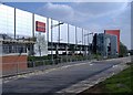
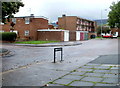
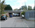
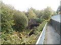
Photos of NP44 1PW


Area Information
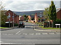
Living in NP44 1PW offers a quiet residential experience within a defined postcode area in Wales. This small residential cluster covers just 4598 square metres and holds a population of 1518 people. Living here means inhabiting a compact environment where daily routines closely mirror those of nearby towns. The area functions as a distinct neighbourhood characterised by its proximity to Cwmbran and access to regional transport links. You will find yourself in a setting where the built environment is intimate, yet connected to wider services. Daily life revolves around a stable community where residents benefit from reasonable mobile coverage and fixed broadband speeds. The location avoids significant planning constraints such as protected woodlands or nature reserves. While the area is small, its integration into the local network ensures that essential amenities remain within practical reach. Residents enjoy low flood risk, providing peace of mind regarding environmental safety. Choosing NP44 1PW gives you a foothold in a community that balances suburban comfort with accessibility.
- Area Type
- Postcode
- Area Size
- 4598 m²
- Population
- 1518
- Population Density
- 1278 people/km²
The property market in NP44 1PW is defined by a housing stock consisting mainly of houses. Only 47 per cent of residents are homeowners, while the remaining households reside in rentals or other rental-based arrangements. This split suggests a mixed market where immediate capital ownership is not universal but still represents a significant portion of the community. The predominance of houses over flats or terraced homes affects the available space and garden areas for prospective buyers. You are entering a market where individual property values may reflect the specific condition of each house rather than a uniform rental yield model. Looking at homes in NP44 1PW requires understanding that this small postcode area operates somewhat independently of larger nearby towns while sharing similar market trends. The relatively low home ownership percentage might indicate opportunities for investment purchases or a need for contemporary rental solutions. Current data shows that more than half of the residents do not own their homes outright. If you view properties here, expect a range of conditions typical of a residential cluster with no protected planning constraints to hinder development or sale.
House Prices in NP44 1PW
Showing 2 properties
| Address | Type | Beds | Baths | Last Sale Price | Last Sale Date | |
|---|---|---|---|---|---|---|
| 13 Gwent Square, Cwmbran, NP44 1PW | retail_financial | - | - | - | - | |
| 17-23 Gwent Square, Cwmbran, NP44 1PW | retail_financial | - | - | - | - |
Energy Efficiency in NP44 1PW
Your lifestyle in NP44 1PW hinges on the shopping and transport facilities found within immediate reach. Five retail outlets serve the local community, anchored by major chains such as M&S Cwmbran, Heron Cwmbran, and Asda Cwmbran. These venues provide comprehensive goods ranging from fashion to groceries, reducing the need for long drives to city centres. Five railway stations are located nearby, offering seamless links to other towns and cities. Cwmbran Railway Station stands out as the primary local hub for trains serving the area. Rogerstone Railway Station and Pontypool & New Inn Railway Station offer additional departure points for various network routes. This concentration of retail and rail options means you can manage weekly shopping and monthly commuting without leaving the wider Cwmbran region. The presence of these established brands ensures consistent quality and variety for daily needs. Living here combines the convenience of large-scale retail with the relative calm of a residential cluster. You gain access to a full spectrum of consumer services without the noise of a high-density city centre. Practicality defines the lifestyle, supported by reliable access to established retail parks and transport interchanges.
Amenities
Schools
Families with children residing in NP44 1PW have access to two notable educational institutions nearby. These include Brookfield Primary School and Our Lady of the Angels R.C School. Both schools are listed under the 'other' category, indicating their specific designation within the local education authority framework. The presence of both institutions offers a choice for parents seeking either local primary education or options with different religious or organisational backgrounds. Brookfield Primary School serves the younger cohort in the neighbourhood, ensuring educational continuity. Our Lady of the Angels R.C School provides an alternative for families aligned with Roman Catholic values or specific denominational requirements. Having schools near NP44 1PW ensures that daily commutes to educational institutions remain short. The proximity of these venues supports families who prioritise access to established institutions over commuting to larger secondary college campuses. You will find that the local education provision meets the immediate needs of children living or moving into this postcode area.
| Rank | School | Type | Entry gender | Ages |
|---|
Explore more schools in this area
Go to Schools tabDemographics
The community in NP44 1PW reflects a settled demographic profile dominated by adults. The median age is 47 years, with the most common age range falling between 30 and 64 years. This indicates a population of established households rather than transient groups of young people. Home ownership stands at 47 per cent, suggesting a significant portion of residents possess capitalised properties. The accommodation type is primarily houses, forming the bulk of the housing stock in this specific location. Predominantly, the ethnic group recorded is White, shaping the cultural fabric of the neighbourhood. With a population density of 1278 people per square kilometre, the area maintains a moderate level of closeness without feeling overcrowded. The age structure supports local independent businesses and community groups. A higher proportion of owner-occupiers versus renters often correlates with greater investment in the local environment. This demographic mix creates a stable social environment where long-term residents form the core of community life.
Household Size
Accommodation Type
Tenure
Ethnic Group
Religion
Household Composition
Age
Household Deprivation
NS-SEC
Explore more demographic insights in this area
Go to Demographics tabPlanning
Planning Constraints
- Flood RiskPremium
- Ramsar Wetland SitesPremium
- Area of Outstanding Natural BeautyPremium
- Protected Nature ReservePremium
- Protected WoodlandPremium
- Crime RiskPremium