Area Overview for NP44 1LR
Photos of NP44 1LR
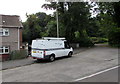
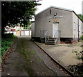
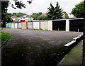

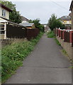

100 photos from this area
Area Information
Key information about the NP44 1LR including its size, population, and administrative classification.
- Area Type
- Postcode
- Area Size
- 3.8 hectares
- Population
- 1422
- Population Density
- 3191 people/km²
House Prices in NP44 1LR
35
Properties
£105,741
Average Sold Price
£26,930
Lowest Price
£170,000
Highest Price
Showing 35 properties
| Address | Type | Beds | Baths | Last Sale Price | Last Sale Date | |
|---|---|---|---|---|---|---|
| 7 Church Wood Road, Pontnewydd, Cwmbran, NP44 1LR | Terraced | 3 | 1 | £170,000 | Feb 2023 | |
| 18 Church Wood Road, Pontnewydd, Cwmbran, NP44 1LR | Terraced | 3 | 1 | £139,000 | Jan 2020 | |
| 4 Church Wood Road, Pontnewydd, Cwmbran, NP44 1LR | Terraced | 3 | 1 | £107,000 | Dec 2019 | |
| 14 Church Wood Road, Pontnewydd, Cwmbran, NP44 1LR | Terraced | 3 | 1 | £110,000 | Nov 2016 | |
| 11 Church Wood Road, Pontnewydd, Cwmbran, NP44 1LR | Terraced | 3 | 1 | £87,000 | Dec 2013 | |
| 16 Church Wood Road, Pontnewydd, Cwmbran, NP44 1LR | house | - | - | £89,000 | Jun 2010 | |
| 31 Church Wood Road, Pontnewydd, Cwmbran, NP44 1LR | house | - | - | £117,000 | Oct 2007 | |
| 2 Church Wood Road, Pontnewydd, Cwmbran, NP44 1LR | house | - | - | £26,930 | Oct 1996 | |
| 5 Church Wood Road, Pontnewydd, Cwmbran, NP44 1LR | Terraced | - | - | - | - | |
| 10 Church Wood Road, Pontnewydd, Cwmbran, NP44 1LR | house | - | - | - | - |
Page 1 of 4
Energy Efficiency in NP44 1LR
Amenities
Schools
| Rank | School | Type | Entry gender | Ages |
|---|
Explore more schools in this area
Go to Schools tabDemographics
Household Size
Two person
most common
Accommodation Type
Houses
most common
Tenure
63
majority
Ethnic Group
White
most common
Religion
N/A
most common
Household Composition
N/A
most common
Age
47
median
Adults (30-64 years)
most common
Household Deprivation
N/A
with no deprivation
NS-SEC
23
in Lower managerial occupations
Explore more demographic insights in this area
Go to Demographics tabPlanning
Planning Constraints
- Flood RiskPremium
- Ramsar Wetland SitesPremium
- Area of Outstanding Natural BeautyPremium
- Protected Nature ReservePremium
- Protected WoodlandPremium
- Crime RiskPremium