Area Overview for NP44 1GH
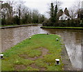
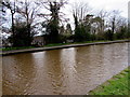
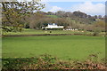
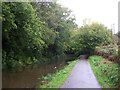
Photos of NP44 1GH


Area Information
The postcode NP44 1GH covers a specific residential cluster in Wales with a population of 2,594 residents. This small area has a high population density of 2,065 people per square kilometre, indicating a tightly built neighbourhood rather than sprawling suburbs. Daily life here centres on the immediate surrounding properties, which form a cohesive community. The area functions as a self-contained domestic zone where neighbours interact regularly within a compact footprint. You will find that the environment is dense yet focused, with most daily activities taking place within walking distance or a short drive. The character of the area is defined by its density, creating a close-knit atmosphere where residents know their immediate surroundings. Living in this postcode means integrating into a settled environment where space is shared among a significant number of households relative to the land area. The layout supports a neighbourhood feel without extending over a wide geographical spread. This concentration makes the area distinct from larger towns or rural villages found elsewhere in the region. The practical reality is a focus on efficiency and proximity within a defined boundary.
- Area Type
- Postcode
- Area Size
- Not available
- Population
- 2594
- Population Density
- 2065 people/km²
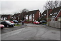
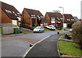
The housing stock in NP44 1GH consists almost entirely of houses, with flats representing a small minority of the available homes. This accommodation type profile creates a landscape of detached and semi-detached properties typical of suburban Welsh neighbourhoods. The area is overwhelmingly owner-occupied, with 74 per cent of residents owning their homes. Rental listings are therefore less common than properties sold through standard estate agencies or direct purchases between owners. Buyers looking at homes in this postcode will face a market driven by retention and ownership rather than student lets or transient tenancies. The predominance of houses means that potential purchases involve conventional single-storey or dual-storey structures rather than apartment blocks. This setup appeals to those seeking traditional gardens and space compared to city living. The local market reflects a settled environment where sellers are likely current occupants looking to move up, down, or out of their properties. Purchasing here requires navigating a conventional buyer-owned ecosystem rather than a high-volume rental turnover sector.
House Prices in NP44 1GH
Showing 22 properties
| Address | Type | Beds | Baths | Last Sale Price | Last Sale Date | |
|---|---|---|---|---|---|---|
| 21 Clos Capel Llwyd, Pontrhydyrun, Cwmbran, NP44 1GH | Semi-detached | - | - | - | - | |
| 9 Clos Capel Llwyd, Pontrhydyrun, Cwmbran, NP44 1GH | Semi-detached | - | - | - | - | |
| 11 Clos Capel Llwyd, Pontrhydyrun, Cwmbran, NP44 1GH | Semi-detached | - | - | - | - | |
| 17 Clos Capel Llwyd, Pontrhydyrun, Cwmbran, NP44 1GH | Semi-detached | - | - | - | - | |
| 7 Clos Capel Llwyd, Pontrhydyrun, Cwmbran, NP44 1GH | Detached | - | - | - | - | |
| 27 Clos Capel Llwyd, Pontrhydyrun, Cwmbran, NP44 1GH | Semi-detached | - | - | - | - | |
| 19 Clos Capel Llwyd, Pontrhydyrun, Cwmbran, NP44 1GH | Detached | - | - | - | - | |
| 3 Clos Capel Llwyd, Pontrhydyrun, Cwmbran, NP44 1GH | Semi-detached | - | - | - | - | |
| 23 Clos Capel Llwyd, Pontrhydyrun, Cwmbran, NP44 1GH | Detached | - | - | - | - | |
| 25 Clos Capel Llwyd, Pontrhydyrun, Cwmbran, NP44 1GH | Semi-detached | - | - | - | - |
Energy Efficiency in NP44 1GH
Residents of NP44 1GH benefit from a strong range of retail and transport options within practical reach. There are five key retail locations nearby, including Aldi Cwmbran, Heron Cwmbran, and Asda Cwmbran for weekly shopping needs. Supermarkets and local stores provide comprehensive provisions without requiring long journeys into larger towns. Beyond shopping, the area is well served by public transport with five railway stations identified nearby. Cwmbran Railway Station, Pontypool & New Inn Railway Station, and Newbridge Railway Station offer direct rail links for commuters and travellers. You can access major cities along the network from these platforms. The proximity to these stations combined with local retail outlets creates a convenient lifestyle where daily necessities and long-distance travel are balanced. Amenities are concentrated enough to reduce the need for a car for routine errands, though a vehicle remains useful for reaching the railway stations quickly. Shopping trips and social outings are easily planned around the locations of Cwmbran and the other noted stations.
Amenities
Schools
Families living in NP44 1GH rely on nearby educational institutions for their children's schooling. The nearest school listed is St David's R.C. Jnr. & Inf. School, which falls under the category of other rather than a specific maintained sector type like community or academy in the provided data. This school serves as the primary educational option for young residents within the immediate vicinity. The limited school data suggests that educational catchment boundaries may extend to broader local areas beyond this single postcode entry. There are no detailed Ofsted ratings provided for this specific institution in the current information set. Consequently, prospective parents must verify performance grades directly with the school or through official government education portals. The presence of a junior and infant school indicates that primary education is accessible nearby, supporting families with younger children. While secondary options or comprehensive schools are not explicitly named in the data for this immediate cluster, the existence of St David's confirms a foundational school presence.
| Rank | School | Type | Entry gender | Ages |
|---|
Explore more schools in this area
Go to Schools tabDemographics
The community in NP44 1GH is dominated by adults aged between 30 and 64 years. The median age for residents is 47, confirming that the area attracts newer households rather than families raising young children or retired couples. None of the population falls below 30 years of age, ensuring a mature demographic profile throughout the neighbourhood. Home ownership stands at a robust 74 per cent, meaning most residents bought their properties outright or through mortgage before renting. Houses make up the primary accommodation type, with flats being the minority option. The predominant ethnic group is White, reflecting a demographic that aligns with the broader local context in parts of Wales. Deprivation data is not provided for this specific location, so direct comparisons regarding income or poverty levels are not possible using the available figures. However, the high home ownership rate suggests a community with significant stability and long-term settlement. The age skew away from younger adults and seniors indicates a workforce-oriented neighbourhood rather than a retirement destination.
Household Size
Accommodation Type
Tenure
Ethnic Group
Religion
Household Composition
Age
Household Deprivation
NS-SEC
Explore more demographic insights in this area
Go to Demographics tabPlanning
Planning Constraints
- Flood RiskPremium
- Ramsar Wetland SitesPremium
- Area of Outstanding Natural BeautyPremium
- Protected Nature ReservePremium
- Protected WoodlandPremium
- Crime RiskPremium