Area Overview for NP4 9LR
Photos of NP4 9LR
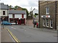
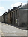
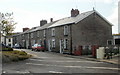

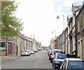

100 photos from this area
Area Information
Key information about the NP4 9LR including its size, population, and administrative classification.
- Area Type
- Postcode
- Area Size
- 8399 m²
- Population
- 1669
- Population Density
- 261 people/km²
House Prices in NP4 9LR
26
Properties
£76,600
Average Sold Price
£29,500
Lowest Price
£150,000
Highest Price
Showing 26 properties
| Address | Type | Beds | Baths | Last Sale Price | Last Sale Date | |
|---|---|---|---|---|---|---|
| 86 Capel Newydd Avenue, Blaenavon, NP4 9LR | Semi-detached | 3 | 1 | £150,000 | Oct 2024 | |
| 80 Capel Newydd Avenue, Blaenavon, NP4 9LR | Semi-detached | 3 | 1 | £135,000 | Jun 2023 | |
| 99 Capel Newydd Avenue, Blaenavon, NP4 9LR | Semi-detached | 3 | 1 | £82,000 | May 2021 | |
| 97 Capel Newydd Avenue, Blaenavon, NP4 9LR | house | - | - | £80,100 | Jan 2021 | |
| 82 Capel Newydd Avenue, Blaenavon, NP4 9LR | house | - | - | £72,000 | Oct 2018 | |
| 92 Capel Newydd Avenue, Blaenavon, NP4 9LR | house | - | - | £59,500 | Jul 2018 | |
| 88 Capel Newydd Avenue, Blaenavon, NP4 9LR | Semi-detached | 3 | 1 | £50,500 | Jun 2016 | |
| 87 Capel Newydd Avenue, Blaenavon, NP4 9LR | Semi-detached | - | - | £95,000 | Mar 2006 | |
| 96 Capel Newydd Avenue, Blaenavon, NP4 9LR | Semi-detached | - | - | £29,500 | Jul 2004 | |
| 94 Capel Newydd Avenue, Blaenavon, NP4 9LR | Semi-detached | - | - | £55,000 | Aug 2003 |
Page 1 of 3
Energy Efficiency in NP4 9LR
Amenities
Schools
| Rank | School | Type | Entry gender | Ages |
|---|
Explore more schools in this area
Go to Schools tabDemographics
Household Size
Family (3-5 people)
most common
Accommodation Type
Houses
most common
Tenure
66
majority
Ethnic Group
White
most common
Religion
N/A
most common
Household Composition
N/A
most common
Age
47
median
Adults (30-64 years)
most common
Household Deprivation
N/A
with no deprivation
NS-SEC
28
in Lower managerial occupations
Explore more demographic insights in this area
Go to Demographics tabPlanning
Planning Constraints
- Flood RiskPremium
- Ramsar Wetland SitesPremium
- Area of Outstanding Natural BeautyPremium
- Protected Nature ReservePremium
- Protected WoodlandPremium
- Crime RiskPremium