Area Overview for NP4 9EW
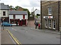
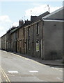
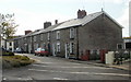
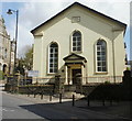
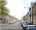
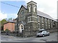
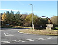
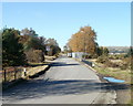
Photos of NP4 9EW
Area Information
NP4 9EW sits within a very specific residential cluster covering just 3844 square metres. With a population of 1,400 people, this compact area forms a tightly knit community situated in Wales. The location defines itself through its small scale, meaning you will know your neighbours and the layout of the streets. Every resident lives within close proximity to the core of this postcode sector, creating an environment where daily life moves at a steady, local pace. The area represents a distinct pocket of the wider landscape, separate from larger urban sprawls. You will find the population density unusually high at 364,159 people per square kilometre, reflecting the dense urban nature of this specific grid reference. This concentration means services and parks are likely nearby, but personal space is defined by the immediate infrastructure. Living in NP4 9EW involves navigating a micro-community where boundaries are clear and the residential character is focused. The postcode captures a moment in the Welsh housing market, offering homes in a location that prioritises proximity over expansive land. Daily life here revolves around the immediate surroundings, with the majority of journeys being short and familiar.
- Area Type
- Postcode
- Area Size
- 3844 m²
- Population
- 1400
- Population Density
- 6859 people/km²
The property market in NP4 9EW is overwhelmingly characterised by owner-occupation. With 65 per cent of homes owned by their residents, the area functions primarily as a market for buy-to-live dwellings rather than an investment rental hub. The accommodation type data confirms that houses make up the vast majority of the housing stock, with flats or bungalows appearing less frequently in this specific postcode configuration. This dominance of houses supports the high home ownership rate, as these properties often accommodate families or multi-generational homes that suit the area's median age of forty-seven. You are likely to encounter a stock of established properties where residents have stayed put for years, evidenced by the low tenant presence. Buying a home in NP4 9EW means joining a community where the residents have already made a long-term commitment to the location. The small area size of 3844 square metres concentrates the market, making inventory movement visible and community-focused. Trade occurs here, but the primary activity involves transfers between existing owner-occupiers or moves between neighbouring properties within the tight residential cluster. The 65 per cent ownership figure is a definitive metric that shapes the local estate economy, reducing the supply of long-term rentals and increasing the prevalence of owner-led neighbourhood initiatives.
House Prices in NP4 9EW
Showing 19 properties
| Address | Type | Beds | Baths | Last Sale Price | Last Sale Date | |
|---|---|---|---|---|---|---|
| 63 Hill Street, Blaenavon, NP4 9EW | Terraced | 2 | 1 | £115,000 | Mar 2024 | |
| 69 Hill Street, Blaenavon, NP4 9EW | Retail | 2 | - | £120,000 | Oct 2023 | |
| 64 Hill Street, Blaenavon, NP4 9EW | Terraced | 3 | 1 | £120,000 | Jan 2023 | |
| 62 Hill Street, Blaenavon, NP4 9EW | house | - | - | £95,000 | Jun 2020 | |
| 76 Hill Street, Blaenavon, NP4 9EW | house | 2 | - | £60,000 | Mar 2020 | |
| 73 Hill Street, Blaenavon, NP4 9EW | house | - | - | £51,000 | Feb 2016 | |
| 71 Hill Street, Blaenavon, NP4 9EW | house | 2 | - | £32,500 | Feb 2015 | |
| 75 Hill Street, Blaenavon, NP4 9EW | Terraced | 2 | - | £65,000 | Nov 2014 | |
| 65 Hill Street, Blaenavon, NP4 9EW | Terraced | 1 | 1 | £63,000 | Dec 2008 | |
| 8 Hill Street, Blaenavon, NP4 9EW | Detached | 2 | 1 | £81,950 | Mar 2004 |
Energy Efficiency in NP4 9EW
Daily life in NP4 9EW offers immediate access to a functional cluster of retail and transport amenities. Five retail outlets are located within practical reach, with Co-op Blaenavon, Co-op Garndiffaith, and Co-op Blaina standing out as the notable local supermarkets. These three specific venues provide the essential grocery shopping required for weekly household runs. For travel outside the immediate area, rail access is robust with five railway stations nearby. Abergavenny Railway Station, Ebbw Vale Parkway Railway Station, and Ebbw Vale Town Railway Station are the key hubs connecting you to the wider region. You can rely on these stations for commuting to Cardiff or other employment centres without needing a private vehicle for long distances. The combination of three local Co-op stores and three major railway stations creates a self-sufficient lifestyle foundation. Residents do not need to travel far for basic supplies or work commutes. The amenities listed are concentrated around the postcode, meaning you can walk or drive short distances to these facilities. This layout supports a practical existence where work and life are balanced by the presence of these specific, named amenities. The proximity of these transport and retail nodes makes living in NP4 9EW efficient and convenient.
Amenities
Schools
Families in NP4 9EW have access to a short list of educational institutions listed in the immediate vicinity. The nearest options include Blaenavon Hillside Nursery School, which serves the very young in the community. For primary education, Hillside Primary School is the designated facility for early schooling in the area. These schools are classified as 'other' types of educational provision, indicating a specific categorisation within the Welsh school system. The mix is limited, reflecting the small population size of 1,400 people within this isolated cluster. Living in NP4 9EW means your children are likely to commute to these specific named schools or utilise local nursery provision before moving to secondary institutions further away. The absence of comprehensive primary chains here suggests a reliance on these single, local entities for early education. Parents must plan their child's schooling route carefully, as the choices are restricted to these two specific venues. The presence of a nursery and a primary school shows that basic educational needs are met, even if the options do not include a wide selection of secondary or special needs colleges nearby. You should verify transport links to these schools to ensure daily travel is manageable within the high-density setting of the postcode.
| Rank | School | Type | Entry gender | Ages |
|---|
Explore more schools in this area
Go to Schools tabDemographics
The people of NP4 9EW have an established demographic profile centred on maturity and stability. The median age for residents is forty-seven, and the most common age group consists of adults between thirty and sixty-four years old. House ownership stands at 65 per cent of the total population, indicating that most households have secured their property and settled into permanent living arrangements. This high figure suggests a community driven by long-term residents rather than short-term tenants or commuters. The predominant ethnic group in the area is White, mirroring the broader national pattern but confirming the specific cultural composition of this postcode. Accommodation types in NP4 9EW consist primarily of houses, which aligns with the higher proportion of owners and families with longer tenures. The demographic data paints a picture of a settled neighbourhood where the workforce is likely represented by experienced labourers and established professionals. You will find a community where generations have built roots, and the housing stock reflects this permanence. The age profile implies that those moving here typically seek stability rather than a transient lifestyle. Children are present, supported by the local age spread, but the core population remains firmly in the adult working bracket. This density of middle-aged homeowners creates a distinct social fabric within the 1,400 residents.
Household Size
Accommodation Type
Tenure
Ethnic Group
Religion
Household Composition
Age
Household Deprivation
NS-SEC
Explore more demographic insights in this area
Go to Demographics tabPlanning
Planning Constraints
- Flood RiskPremium
- Ramsar Wetland SitesPremium
- Area of Outstanding Natural BeautyPremium
- Protected Nature ReservePremium
- Protected WoodlandPremium
- Crime RiskPremium