Area Overview for NP4 7LZ
Photos of NP4 7LZ
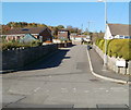
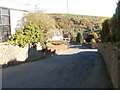
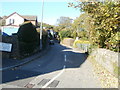
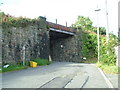
100 photos from this area
Area Information
Key information about the NP4 7LZ including its size, population, and administrative classification.
- Area Type
- Postcode
- Area Size
- 1.5 hectares
- Population
- 1446
- Population Density
- 3457 people/km²
House Prices in NP4 7LZ
24
Properties
£131,314
Average Sold Price
£20,500
Lowest Price
£290,000
Highest Price
Showing 24 properties
| Address | Type | Beds | Baths | Last Sale Price | Last Sale Date | |
|---|---|---|---|---|---|---|
| 2 Stanley Road, Garndiffaith, Pontypool, NP4 7LZ | Cottage | 2 | 2 | £177,500 | Jul 2024 | |
| 26-27 Stanley Road, Garndiffaith, Pontypool, NP4 7LZ | house | 4 | - | £222,000 | Dec 2017 | |
| The Gables, Stanley Road, Garndiffaith, Pontypool, NP4 7LZ | house | - | - | £290,000 | Jul 2016 | |
| 30 Stanley Road, Garndiffaith, Pontypool, NP4 7LZ | house | 2 | - | £86,000 | Feb 2016 | |
| Cartref, Stanley Road, Garndiffaith, Pontypool, NP4 7LZ | house | - | - | £160,000 | Nov 2015 | |
| 28 Stanley Road, Garndiffaith, Pontypool, NP4 7LZ | house | - | - | £172,500 | Dec 2014 | |
| 31 Stanley Road, Garndiffaith, Pontypool, NP4 7LZ | house | - | - | £20,500 | Jul 2012 | |
| 32 Stanley Road, Garndiffaith, Pontypool, NP4 7LZ | house | 1 | - | £54,000 | Apr 2004 | |
| 25A Stanley Road, Garndiffaith, Pontypool, NP4 7LZ | Cottage | 4 | 1 | £139,950 | Nov 2003 | |
| The Newlands, 38 Stanley Road, Garndiffaith, Pontypool, NP4 7LZ | Detached | - | - | £66,000 | Jun 1999 |
Page 1 of 3
Energy Efficiency in NP4 7LZ
Amenities
Schools
| Rank | School | Type | Entry gender | Ages |
|---|
Explore more schools in this area
Go to Schools tabDemographics
Household Size
Family (3-5 people)
most common
Accommodation Type
Houses
most common
Tenure
46
majority
Ethnic Group
White
most common
Religion
N/A
most common
Household Composition
N/A
most common
Age
47
median
Adults (30-64 years)
most common
Household Deprivation
N/A
with no deprivation
NS-SEC
16
in Lower managerial occupations
Explore more demographic insights in this area
Go to Demographics tabPlanning
Planning Constraints
- Flood RiskPremium
- Ramsar Wetland SitesPremium
- Area of Outstanding Natural BeautyPremium
- Protected Nature ReservePremium
- Protected WoodlandPremium
- Crime RiskPremium