Area Overview for NP4 7BL
Photos of NP4 7BL
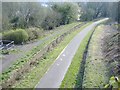

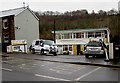
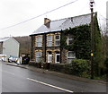
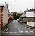
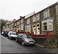
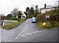
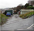
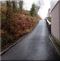
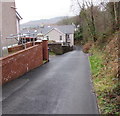
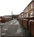
95 photos from this area
Area Information
Key information about the NP4 7BL including its size, population, and administrative classification.
- Area Type
- Postcode
- Area Size
- 3976 m²
- Population
- 2036
- Population Density
- 2577 people/km²
House Prices in NP4 7BL
18
Properties
£95,500
Average Sold Price
£28,000
Lowest Price
£156,000
Highest Price
Showing 18 properties
| Address | Type | Beds | Baths | Last Sale Price | Last Sale Date | |
|---|---|---|---|---|---|---|
| 10 Owendale Terrace, Abersychan, Pontypool, NP4 7BL | Terraced | 3 | 1 | £156,000 | Mar 2025 | |
| 9 Owendale Terrace, Abersychan, Pontypool, NP4 7BL | Terraced | 2 | 2 | £149,000 | Jan 2024 | |
| 5 Owendale Terrace, Abersychan, Pontypool, NP4 7BL | Retail | 2 | 2 | £91,500 | Mar 2023 | |
| 16 Owendale Terrace, Abersychan, Pontypool, NP4 7BL | Terraced | - | - | £55,000 | Apr 2022 | |
| 7 Owendale Terrace, Abersychan, Pontypool, NP4 7BL | Terraced | 2 | 1 | £90,000 | Oct 2020 | |
| 3 Owendale Terrace, Abersychan, Pontypool, NP4 7BL | Terraced | 3 | 1 | £98,000 | Mar 2020 | |
| 12 Owendale Terrace, Abersychan, Pontypool, NP4 7BL | Terraced | 3 | 1 | £73,000 | Feb 2020 | |
| 4 Owendale Terrace, Abersychan, Pontypool, NP4 7BL | house | - | - | £130,000 | May 2017 | |
| 2 Owendale Terrace, Abersychan, Pontypool, NP4 7BL | house | 2 | - | £91,500 | Mar 2014 | |
| 11 Owendale Terrace, Abersychan, Pontypool, NP4 7BL | Terraced | 2 | 1 | £65,000 | Nov 2009 |
Page 1 of 2
Energy Efficiency in NP4 7BL
Amenities
Schools
| Rank | School | Type | Entry gender | Ages |
|---|
Explore more schools in this area
Go to Schools tabDemographics
Household Size
One person
most common
Accommodation Type
Houses
most common
Tenure
57
majority
Ethnic Group
White
most common
Religion
N/A
most common
Household Composition
N/A
most common
Age
47
median
Adults (30-64 years)
most common
Household Deprivation
N/A
with no deprivation
NS-SEC
25
in Lower managerial occupations
Explore more demographic insights in this area
Go to Demographics tabPlanning
Planning Constraints
- Flood RiskPremium
- Ramsar Wetland SitesPremium
- Area of Outstanding Natural BeautyPremium
- Protected Nature ReservePremium
- Protected WoodlandPremium
- Crime RiskPremium