Area Overview for NP4 6BN
Photos of NP4 6BN


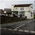
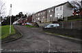
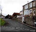
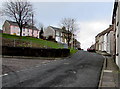
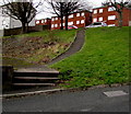
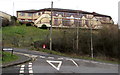

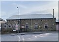

64 photos from this area
Area Information
Key information about the NP4 6BN including its size, population, and administrative classification.
- Area Type
- Postcode
- Area Size
- 3.5 hectares
- Population
- 1157
- Population Density
- 159 people/km²
House Prices in NP4 6BN
10
Properties
£154,250
Average Sold Price
£46,000
Lowest Price
£340,000
Highest Price
Showing 10 properties
| Address | Type | Beds | Baths | Last Sale Price | Last Sale Date | |
|---|---|---|---|---|---|---|
| Tumblewood Cottage, 23 Twissells Road, Tranch, Pontypool, NP4 6BN | house | - | - | £340,000 | Jan 2022 | |
| 22 Twissells Road, Tranch, Pontypool, NP4 6BN | house | - | - | £146,000 | Jul 2012 | |
| Fir Tree Cottage, Twissells Road, Tranch, Pontypool, NP4 6BN | Detached | - | - | £46,000 | Jun 1996 | |
| Cariad, Twissells Road, Tranch, Pontypool, NP4 6BN | Detached | - | - | £85,000 | Nov 1995 | |
| 28 Twissells Road, Tranch, Pontypool, NP4 6BN | Detached | - | - | - | - | |
| Birch Grove, Twissells Road, Tranch, Pontypool, NP4 6BN | Detached | - | - | - | - | |
| Hollycroft, Twissells Road, Tranch, Pontypool, NP4 6BN | Detached | - | - | - | - | |
| 4, Woodbine Cottages, Twissells Road, Tranch, Pontypool, NP4 6BN | Terraced | - | - | - | - | |
| Swn-y-geynt, 2 Twissells Road, Tranch, Pontypool, NP4 6BN | Detached | - | - | - | - | |
| Sunnyside Cottage, 29 Twissells Road, Tranch, Pontypool, NP4 6BN | Detached | - | - | - | - |
Energy Efficiency in NP4 6BN
Amenities
Schools
| Rank | School | Type | Entry gender | Ages |
|---|
Explore more schools in this area
Go to Schools tabDemographics
Household Size
Two person
most common
Accommodation Type
Houses
most common
Tenure
72
majority
Ethnic Group
White
most common
Religion
N/A
most common
Household Composition
N/A
most common
Age
47
median
Adults (30-64 years)
most common
Household Deprivation
N/A
with no deprivation
NS-SEC
25
in Lower managerial occupations
Explore more demographic insights in this area
Go to Demographics tabPlanning
Planning Constraints
- Flood RiskPremium
- Ramsar Wetland SitesPremium
- Area of Outstanding Natural BeautyPremium
- Protected Nature ReservePremium
- Protected WoodlandPremium
- Crime RiskPremium