Area Overview for NP4 5ET
Photos of NP4 5ET
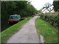

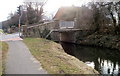
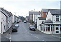
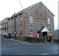

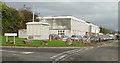
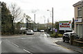
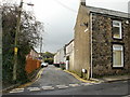
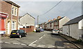
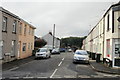
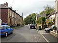
100 photos from this area
Area Information
Key information about the NP4 5ET including its size, population, and administrative classification.
- Area Type
- Postcode
- Area Size
- 3344 m²
- Population
- 2441
- Population Density
- 2493 people/km²
House Prices in NP4 5ET
14
Properties
£88,285
Average Sold Price
£18,000
Lowest Price
£180,000
Highest Price
Showing 14 properties
| Address | Type | Beds | Baths | Last Sale Price | Last Sale Date | |
|---|---|---|---|---|---|---|
| 11 Waterloo Court, Sebastopol, Pontypool, NP4 5ET | Terraced | 3 | 1 | £180,000 | Oct 2023 | |
| 8 Waterloo Court, Sebastopol, Pontypool, NP4 5ET | Terraced | 2 | 1 | £115,000 | Jan 2023 | |
| 14 Waterloo Court, Sebastopol, Pontypool, NP4 5ET | Terraced | 2 | 1 | £155,000 | Mar 2022 | |
| 13 Waterloo Court, Sebastopol, Pontypool, NP4 5ET | Terraced | 3 | 1 | £120,000 | Feb 2020 | |
| 5 Waterloo Court, Sebastopol, Pontypool, NP4 5ET | Terraced | 3 | 1 | £60,000 | Mar 2019 | |
| 1 Waterloo Court, Sebastopol, Pontypool, NP4 5ET | house | 2 | - | £84,000 | Aug 2013 | |
| 12 Waterloo Court, Sebastopol, Pontypool, NP4 5ET | house | 2 | - | £106,000 | Oct 2010 | |
| 9 Waterloo Court, Sebastopol, Pontypool, NP4 5ET | house | - | - | £93,000 | Apr 2006 | |
| 2 Waterloo Court, Sebastopol, Pontypool, NP4 5ET | Terraced | 3 | 1 | £105,000 | Aug 2005 | |
| 7 Waterloo Court, Sebastopol, Pontypool, NP4 5ET | Terraced | - | - | £23,750 | Jun 2002 |
Page 1 of 2
Energy Efficiency in NP4 5ET
Amenities
Schools
| Rank | School | Type | Entry gender | Ages |
|---|
Explore more schools in this area
Go to Schools tabDemographics
Household Size
Family (3-5 people)
most common
Accommodation Type
Houses
most common
Tenure
80
majority
Ethnic Group
White
most common
Religion
N/A
most common
Household Composition
N/A
most common
Age
47
median
Adults (30-64 years)
most common
Household Deprivation
N/A
with no deprivation
NS-SEC
37
in Lower managerial occupations
Explore more demographic insights in this area
Go to Demographics tabPlanning
Planning Constraints
- Flood RiskPremium
- Ramsar Wetland SitesPremium
- Area of Outstanding Natural BeautyPremium
- Protected Nature ReservePremium
- Protected WoodlandPremium
- Crime RiskPremium