Area Overview for NP4 5DN
Photos of NP4 5DN
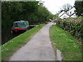
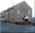
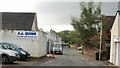
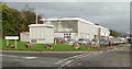
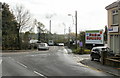
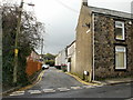
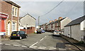
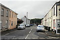
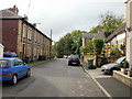
100 photos from this area
Area Information
Key information about the NP4 5DN including its size, population, and administrative classification.
- Area Type
- Postcode
- Area Size
- 3.2 hectares
- Population
- 1393
- Population Density
- 1614 people/km²
House Prices in NP4 5DN
25
Properties
£87,608
Average Sold Price
£32,000
Lowest Price
£169,950
Highest Price
Showing 25 properties
| Address | Type | Beds | Baths | Last Sale Price | Last Sale Date | |
|---|---|---|---|---|---|---|
| 19 Florence Place, Griffithstown, Pontypool, NP4 5DN | Terraced | 3 | 1 | £169,950 | Jan 2023 | |
| 23 Florence Place, Griffithstown, Pontypool, NP4 5DN | house | - | - | £134,000 | Dec 2021 | |
| 17 Florence Place, Griffithstown, Pontypool, NP4 5DN | Terraced | 3 | - | £124,000 | Jul 2017 | |
| 26 Florence Place, Griffithstown, Pontypool, NP4 5DN | Terraced | 2 | 1 | £83,000 | Sep 2016 | |
| 14 Florence Place, Griffithstown, Pontypool, NP4 5DN | Terraced | 2 | 1 | £67,000 | Jan 2016 | |
| 15 Florence Place, Griffithstown, Pontypool, NP4 5DN | Terraced | - | - | £115,000 | Nov 2012 | |
| 24 Florence Place, Griffithstown, Pontypool, NP4 5DN | Terraced | 2 | 1 | £100,000 | Jul 2009 | |
| 10 Florence Place, Griffithstown, Pontypool, NP4 5DN | Terraced | - | - | £115,000 | Dec 2006 | |
| 22 Florence Place, Griffithstown, Pontypool, NP4 5DN | house | - | - | £74,950 | Oct 2003 | |
| 12 Florence Place, Griffithstown, Pontypool, NP4 5DN | Terraced | - | - | £39,000 | Jun 2001 |
Page 1 of 3
Energy Efficiency in NP4 5DN
Amenities
Schools
| Rank | School | Type | Entry gender | Ages |
|---|
Explore more schools in this area
Go to Schools tabDemographics
Household Size
One person
most common
Accommodation Type
Houses
most common
Tenure
68
majority
Ethnic Group
White
most common
Religion
N/A
most common
Household Composition
N/A
most common
Age
47
median
Adults (30-64 years)
most common
Household Deprivation
N/A
with no deprivation
NS-SEC
30
in Lower managerial occupations
Explore more demographic insights in this area
Go to Demographics tabPlanning
Planning Constraints
- Flood RiskPremium
- Ramsar Wetland SitesPremium
- Area of Outstanding Natural BeautyPremium
- Protected Nature ReservePremium
- Protected WoodlandPremium
- Crime RiskPremium