Area Overview for NP4 5BZ
Photos of NP4 5BZ
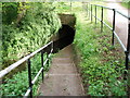

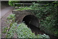
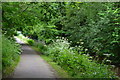
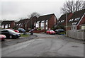
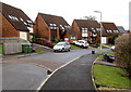
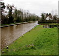
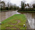
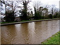


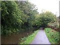
56 photos from this area
Area Information
Key information about the NP4 5BZ including its size, population, and administrative classification.
- Area Type
- Postcode
- Area Size
- 3.5 hectares
- Population
- 1435
- Population Density
- 2263 people/km²
House Prices in NP4 5BZ
31
Properties
£63,956
Average Sold Price
£14,600
Lowest Price
£123,000
Highest Price
Showing 31 properties
| Address | Type | Beds | Baths | Last Sale Price | Last Sale Date | |
|---|---|---|---|---|---|---|
| 36 Oaklands Road, Sebastopol, Pontypool, NP4 5BZ | Flat | 2 | 1 | £110,000 | Feb 2024 | |
| 34 Oaklands Road, Sebastopol, Pontypool, NP4 5BZ | Semi-detached | 2 | 1 | £72,000 | Mar 2017 | |
| 32 Oaklands Road, Sebastopol, Pontypool, NP4 5BZ | house | - | - | £100,000 | Oct 2015 | |
| 59 Oaklands Road, Sebastopol, Pontypool, NP4 5BZ | house | - | - | £123,000 | Feb 2011 | |
| 61 Oaklands Road, Sebastopol, Pontypool, NP4 5BZ | house | - | - | £14,600 | Jul 1999 | |
| 54 Oaklands Road, Sebastopol, Pontypool, NP4 5BZ | house | - | - | £33,500 | Apr 1998 | |
| 57 Oaklands Road, Sebastopol, Pontypool, NP4 5BZ | Semi-detached | - | - | £48,500 | Nov 1997 | |
| 69 Oaklands Road, Sebastopol, Pontypool, NP4 5BZ | house | - | - | £37,000 | Nov 1997 | |
| 71 Oaklands Road, Sebastopol, Pontypool, NP4 5BZ | Semi-detached | - | - | £37,000 | Oct 1996 | |
| 44 Oaklands Road, Sebastopol, Pontypool, NP4 5BZ | Semi-detached | - | - | - | - |
Page 1 of 4
Energy Efficiency in NP4 5BZ
Amenities
Schools
| Rank | School | Type | Entry gender | Ages |
|---|
Explore more schools in this area
Go to Schools tabDemographics
Household Size
Two person
most common
Accommodation Type
Houses
most common
Tenure
54
majority
Ethnic Group
White
most common
Religion
N/A
most common
Household Composition
N/A
most common
Age
47
median
Adults (30-64 years)
most common
Household Deprivation
N/A
with no deprivation
NS-SEC
19
in Lower managerial occupations
Explore more demographic insights in this area
Go to Demographics tabPlanning
Planning Constraints
- Flood RiskPremium
- Ramsar Wetland SitesPremium
- Area of Outstanding Natural BeautyPremium
- Protected Nature ReservePremium
- Protected WoodlandPremium
- Crime RiskPremium