Area Overview for NP18 1GQ
Photos of NP18 1GQ
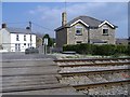


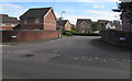
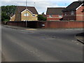
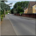
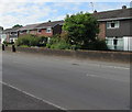
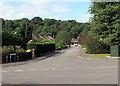
100 photos from this area
Area Information
Key information about the NP18 1GQ including its size, population, and administrative classification.
- Area Type
- Postcode
- Area Size
- 7.0 hectares
- Population
- 1380
- Population Density
- 402 people/km²
House Prices in NP18 1GQ
15
Properties
£219,875
Average Sold Price
£22,000
Lowest Price
£430,000
Highest Price
Showing 15 properties
| Address | Type | Beds | Baths | Last Sale Price | Last Sale Date | |
|---|---|---|---|---|---|---|
| Mulberry House, Station Road, Ponthir, Cwmbran, NP18 1GQ | house | - | - | £315,000 | Dec 2020 | |
| Laurels, Station Road, Ponthir, Cwmbran, NP18 1GQ | Detached | 3 | 1 | £430,000 | Aug 2020 | |
| Glenlyn, 0 Station Road, Ponthir, Newport, NP18 1GQ | Semi-detached | 3 | 1 | £290,000 | Jul 2018 | |
| Willow Cottage, Station Road, Ponthir, Cwmbran, NP18 1GQ | house | - | - | £210,000 | Dec 2015 | |
| Pen Biddle, Station Road, Ponthir, Cwmbran, NP18 1GQ | Detached | 2 | - | £275,000 | Jun 2013 | |
| Ivy Cottage, Station Road, Ponthir, Cwmbran, NP18 1GQ | Semi-detached | - | - | £100,000 | Sep 2005 | |
| The Willows, Station Road, Ponthir, Cwmbran, NP18 1GQ | Detached | - | - | £117,000 | Nov 1996 | |
| Barberry Cottage, Station Road, Ponthir, Cwmbran, NP18 1GQ | house | - | - | £22,000 | Apr 1995 | |
| Beechcroft, 0 Station Road, Ponthir, Newport, NP18 1GQ | Detached | 3 | 1 | - | - | |
| Station House, Station Road, Ponthir, Cwmbran, NP18 1GQ | house | - | - | - | - |
Page 1 of 2
Energy Efficiency in NP18 1GQ
Amenities
Schools
| Rank | School | Type | Entry gender | Ages |
|---|
Explore more schools in this area
Go to Schools tabDemographics
Household Size
Two person
most common
Accommodation Type
Houses
most common
Tenure
91
majority
Ethnic Group
White
most common
Religion
N/A
most common
Household Composition
N/A
most common
Age
47
median
Adults (30-64 years)
most common
Household Deprivation
N/A
with no deprivation
NS-SEC
49
in Lower managerial occupations
Explore more demographic insights in this area
Go to Demographics tabPlanning
Planning Constraints
- Flood RiskPremium
- Ramsar Wetland SitesPremium
- Area of Outstanding Natural BeautyPremium
- Protected Nature ReservePremium
- Protected WoodlandPremium
- Crime RiskPremium