Area Overview for Henllys Community
Photos of Henllys Community


Area Information
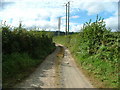
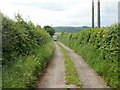
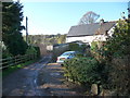
Henllys Community is a civil parish situated in Wales that covers an area of 10.7 km². Living in Henllys Community offers a distinctively rural experience defined by its expansive green space and quiet atmosphere. The parish operates independently as a formal administrative unit within the county structure, providing a clear legal and geographical identity for residents. Daily life here revolves around the natural surroundings that dominate this ten kilometre square of land. You will find yourself in an environment where the pace of life is generally slower than in urban centres. The population dynamics suggest a community tailored to specific life stages, with the median age standing at 70. This demographic reality shapes the local services and social environment. Every square kilometre contributes to the total footprint of Henllys Community, creating a defined boundary for local governance. Whether you are driving through the parish boundaries or walking along its perimeters, the scale remains manageable and approachable. This area does not offer the anonymity of a large city; instead, you live within a clearly demarcated rural setting in Wales.
- Area Type
- Parish
- Area Size
- 10.7 km²
- Population
- Not available
- Population Density
- Not available
Demographics
The demographic profile of Henllys Community reveals a population heavily skewed towards older age groups. The median age across the parish is 70, indicating that half the population is older than this figure. Most common age data indicates that the "Age: Total" category represents the broadest demographic segment available. Nearly all households in Henllys Community own their homes, with a home ownership rate of 87 percent. This high percentage suggests a community composed overwhelmingly of long-term residents rather than transient tenants. Household composition data confirms that total household numbers form the basis of local planning and service delivery. Accommodation type statistics cover the entire stock, showing no significant rental sector driving the local market. Ethnically, the predominant group makes up the total population, reflecting the standard composition for rural Welsh parishes. Religious affiliation data covers the total population, showing adherence to traditional patterns found in the region. You are entering an area where the majority of people have settled permanently. The high ownership rate of 87% means you will be looking to purchase rather than rent. The age profile indicates a retirement-focused environment where the bustle of young families is less evident.
Household Size
Accommodation Type
Tenure
Ethnic Group
Religion
Household Composition
Age
Household Deprivation
NS-SEC
Explore more demographic insights in this area
Go to Demographics tabPlanning
Planning Constraints
- Flood RiskPremium
- Ramsar Wetland SitesPremium
- Area of Outstanding Natural BeautyPremium
- Protected Nature ReservePremium
- Protected WoodlandPremium
- Crime RiskPremium