Area Overview for Panteg Community
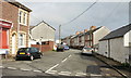
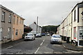
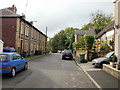
Photos of Panteg Community

Area Information
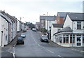
Panteg Community stands as a distinct unitary electoral division within Wales, covering a compact geographical area of 3.2 square kilometres. Living in Panteg Community offers you access to a defined space that balances residential focus with necessary local amenities. The area serves as a recognised settlement where daily life hinges on its specific location and limits. You will find this area defined by clear boundaries and a moderate size that often fosters a contained environment for its inhabitants. This unitary electoral division functions independently within the local government structure, providing a stable administrative identity for residents. The community is distinct from larger metropolitan zones due to its relatively small footprint. Prospective buyers should understand that Panteg Community is a specific, bounded locality rather than a sprawling region. The size of the area influences how quickly you can traverse it and how easy it is to maintain familiarity within the neighbourhood. Knowing the exact square kilometreage helps you gauge the scale of infrastructure and service provision available to homes in Panteg Community. Your experience here will depend heavily on how you utilise the limited land efficiently. This area represents a singular slice of Welsh residential living with its own administrative and geographical characteristics.
- Area Type
- Parish
- Area Size
- 3.2 km²
- Population
- Not available
- Population Density
- Not available
Demographics
The people residing in Panteg Community display a very specific age profile that heavily skews towards older residents. You will find that the median age is remarkable at seventy years old, indicating a retirement-focused population. Most individuals living in this area fall into the age range associated with later life, which shapes the local demand for services and social activities. Home ownership is the dominant form of tenure, with seventy-four per cent of residents owning their properties outright or with a mortgage. This high rate suggests that families moving into homes in Panteg Community often do so with significant capital or after inheriting property. The household composition reflects this demographic reality, likely consisting of single-person households or couples without dependent children. While the data does not specify ethnic groups or religious affiliations in detail, the age profile points to a traditional community structure. The accommodation type breakdown aligns with this picture of established, long-term residents. You should expect a neighbourhood where neighbours may have been in place for decades. The lack of young families in the statistical record is a defining feature of living in Panteg Community today.
Household Size
Accommodation Type
Tenure
Ethnic Group
Religion
Household Composition
Age
Household Deprivation
NS-SEC
Explore more demographic insights in this area
Go to Demographics tabPlanning
Planning Constraints
- Flood RiskPremium
- Ramsar Wetland SitesPremium
- Area of Outstanding Natural BeautyPremium
- Protected Nature ReservePremium
- Protected WoodlandPremium
- Crime RiskPremium