Area Overview for New Inn Community
Photos of New Inn Community


Area Information
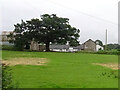
New Inn Community is a distinctive unitary electoral division located in Wales, covering a total area of 11.9 square kilometres. Living here means inhabiting a space defined by significant age demographics and established home ownership patterns rather than transient urban growth. The area is recognisable for its mature character, with a median age of 70 residents making it one of the most senior-populated communities in the region. This demographic profile shapes the daily rhythm of life around local services and community facilities designed for older adults. You will find a neighbourhood where stability is the norm, evidenced by a 79% home ownership rate that suggests long-term residency rather than a high turnover of short-term tenants or purchasers. The landscape of New Inn Community lacks the constraints of protected nature reserves, Ramsar wetland sites, or Areas of Outstanding Natural Beauty, which offers a degree of flexibility for land use while maintaining a specific environmental texture. The presence of protected woodland adds a layer of greenery that is a factual part of the local geography. For those considering homes in New Inn Community, the digital infrastructure supports modern lifestyles with a fixed broadband score of 97 out of 100, indicating excellent internet quality. This high connectivity level ensures that remote working is viable even as the population leans towards retirement age. Mobile coverage scores 84 out of 100, providing reliable connection for the majority of the district. The community functions as a self-contained entity where residents rely heavily on local amenities due to its limited size and established ownership base.
- Area Type
- Parish
- Area Size
- 11.9 km²
- Population
- Not available
- Population Density
- Not available
Demographics
The population of New Inn Community presents a clear and specific demographic picture, centred around a median age of 70 years. This figure confirms that the area is predominantly occupied by older residents, creating a social environment bespoke to the needs of retirees and those seeking a quiet retirement setting. The most common age range data indicates that the total population falls heavily within this senior bracket, distinguishing New Inn Community from younger, family-oriented suburbs. You can expect neighbours who have likely lived in their properties for decades, contributing to the high 79% home ownership rate. Seven out of every ten households in New Inn Community are owner-occupied, which fosters a sense of permanence and community investment. Household composition, accommodation types, and the predominant ethnic group are recorded as total categories in the available data, meaning the specific breakdown of single-person homes, couples, or families is not detailed in the current figures. Similarly, religious affiliation data is not granular enough to highlight specific denominations within the 11.9 square kilometre boundary. These general categories reflect a mature community where demographic trends have stabilised over many years. The absence of younger age groups in the primary data suggests limited new construction or migration of families with children. Consequently, the social fabric of New Inn Community revolves around adult interactions and leisure rather than school-run traffic or playground activity. The ownership statistics also imply lower rental demand compared to areas with younger populations, influencing the local market dynamics significantly. With a median age of 70, the demand for sheltered housing or homes adapted for mobility may be higher than the regional average. This demographic reality shapes the availability of properties, often filtering the market towards larger family home conversions or detached residences suitable for one or two older occupants.
Household Size
Accommodation Type
Tenure
Ethnic Group
Religion
Household Composition
Age
Household Deprivation
NS-SEC
Explore more demographic insights in this area
Go to Demographics tabPlanning
Planning Constraints
- Flood RiskPremium
- Ramsar Wetland SitesPremium
- Area of Outstanding Natural BeautyPremium
- Protected Nature ReservePremium
- Protected WoodlandPremium
- Crime RiskPremium