Area Overview for Abersychan Community
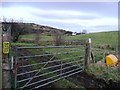
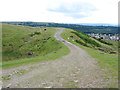
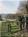
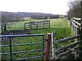
Photos of Abersychan Community
Area Information
Abersychan Community sits north of Pontypool in Torfaen, Wales, spanning 24.3 km² across seven distinct settlements. These include Abersychan, Cwmavon, Garndiffaith, Pentwyn, Talywain, Varteg, and Victoria Village. You live within a historic industrial zone that formed part of the easternmost valley of the South Wales Coalfield. The area dates back to 1844 when it became an ecclesiastical parish formed from Trevethin. Local history recalls the Abersychan Gas Company, established in 1870, alongside its legacy as a notable birthplace for politicians Roy Jenkins, Don Touhig, and Paul Murphy. You will encounter landmarks such as the former Glansychan House, built around 1863 for grocer Thomas Lewis, and the current Abersychan Comprehensive School. While the former Victoria Primary School closed in 2018, the community retains active facilities like the Abersychan Rugby Club. With a population of 3,077, life here moves at a measured pace typical of a small civil parish. The environment offers access to valley settlements without the density of larger towns. You gain a clear view of the area's identity as a preserved county location within Gwent, blending working heritage with modern residential utility.
- Area Type
- Parish
- Area Size
- 24.3 km²
- Population
- 3077
- Population Density
- 126 people/km²
Demographics
The people who call Abersychan Community home form a distinct demographic profile defined by longevity. The median age stands at 70, placing the community far above the national average for younger populations. Households here generally consist of older residents rather than families with young children or transient single workers. Ownership remains highly prevalent, with 66% of residents owning their homes outright or with a mortgage. This high rate of ownership suggests a stable community where long-term families have settled. The remaining households likely comprise social or private rentals, though specific breakdown figures are not provided. The area does not show data on predominant ethnic groups or religious makeup, indicating a homogenous population profile common in retired regions of South Wales. You can expect a quiet neighbourhood where neighbours have lived in their properties for decades. The population density sits at 126 people per km², creating a setting that feels spacious compared to urban centres. Daily interactions are likely reserved for local shops along the high street or community hall events. The absence of younger demographic data implies limited recent migration into the parish.
Household Size
Accommodation Type
Tenure
Ethnic Group
Religion
Household Composition
Age
Household Deprivation
NS-SEC
Explore more demographic insights in this area
Go to Demographics tabPlanning
Planning Constraints
- Flood RiskPremium
- Ramsar Wetland SitesPremium
- Area of Outstanding Natural BeautyPremium
- Protected Nature ReservePremium
- Protected WoodlandPremium
- Crime RiskPremium