Area Overview for Townhill Community
Photos of Townhill Community
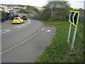
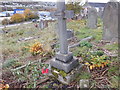
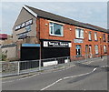
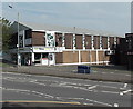
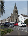
Area Information
Townhill Community stands as a distinct civil parish within the Abertawe district of Swansea, Wales. You will find this residential area covers 1.8 km², offering a concentrated village feel within a council estate established primarily in the 1920s. The site of the estate was formerly known as Graig Llwyd, a woodland and open land area that became farms following an enclosure law in 1762. Today, the environment is dominated by the planned layout designed by Raymond Unwin and Borough Surveyor George Bell. A teacher training college occupied the western side of the estate from 1912 until its closure in 2018, while the Jewish community established a burial ground on the hill in 1768. Modern daily life in Townhill is centred around specific landmarks. Townhill Community primary school and a public library sit atop the hill, alongside nursery facilities and playing fields. Nearby, the Baptist Church continues to hold services in its original late 1920s building, and St Nicholas on the Hill serves the wider parish. The Rosehill Quarry offers a unique recreational space, transforming a former stone extraction site into a community park with BMX tracks. Living in Townhill Community means residing in a place with deep historical roots, now maintained by the Rosehill Quarry Group. The area remains a functional residential hub, though data regarding specific population counts or detailed acreage breakdowns is not included in this overview. Your focus here is the continuity of community facilities that have supported residents since the inter-war period.
- Area Type
- Parish
- Area Size
- 1.8 km²
- Population
- Not available
- Population Density
- Not available
Demographics
The demographic profile of Townhill Community reveals a significant portion of residents are older adults. The median age for the population is 70 years, indicating a community dominated by the senior age group. This statistic shapes the local atmosphere, influencing noise levels, social activities, and service demands. While the most common age range is not specified as a single bracket, the median figure confirms this older skew is the defining characteristic. Household composition data in the provided records is given in total form, suggesting a need to consult local registers for precise family unit breakdowns. Home ownership represents 30% of households, which implies that the majority of addresses are privately rented or subject to other tenure arrangements. This high rental proportion aligns with the area's origins as council housing built under the 1919 Housing Act. Accommodation types are listed as total data, meaning specific ratios of terraced to semi-detached homes are not immediately visible in these figures. Diversity metrics, including predominant ethnic groups and religious affiliations, are similarly recorded in total form. You should be aware that living here involves navigating a community where individual tenancy rights are likely weighted heavily due to the low ownership rate. The age structure suggests a quiet neighbourhood with very few young families, unless local data suggests a cluster not reflected in the median.
Household Size
Accommodation Type
Tenure
Ethnic Group
Religion
Household Composition
Age
Household Deprivation
NS-SEC
Explore more demographic insights in this area
Go to Demographics tabPlanning
Planning Constraints
- Flood RiskPremium
- Ramsar Wetland SitesPremium
- Area of Outstanding Natural BeautyPremium
- Protected Nature ReservePremium
- Protected WoodlandPremium
- Crime RiskPremium