Area Overview for SA6 8NU
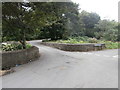
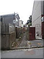
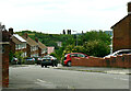
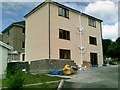
Photos of SA6 8NU


Area Information
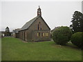
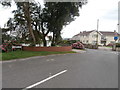
Living in SA6 8NU offers a settled residential experience within a specific postcode cluster in Wales. This small area houses a population of 1,442, creating a close-knit community where neighbours are likely to know one another. The setting is distinctly residential, serving as a quiet backdrop for those seeking stability rather than urban energy. You will find this location provides a sense of calm while remaining accessible to the wider Swansea region. Daily life revolves around a consistent routine, supported by the predictable nature of local housing and infrastructure. The area caters specifically to adults who value a stable environment, often serving as a base for families and established residents looking to put down roots. For anyone considering homes in this postcode, you can expect a neighbourhood defined by its residential character and proximity to key transport links. The environment is practical and functional, designed for people who prioritise a peaceful domestic setting over high-energy entertainment. Your morning commute and evening relaxation are smoothed by the straightforward nature of the local layout.
- Area Type
- Postcode
- Area Size
- Not available
- Population
- 1442
- Population Density
- 1781 people/km²
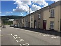
The property market in SA6 8NU is shaped almost entirely by owner-occupied interests. With 67% of the population owning their homes, the area functions as a stable, long-term residential market rather than a dynamic rental hub. Houses dominate the accommodation landscape, meaning you will find single-family homes rather than high-density flats or apartments. This housing stock typically appeals to those seeking more space and garden access, catering effectively to the adult population aged 30 to 64. The low population count of 1,442 suggests a quiet market with fewer transactions moving through each year. For buyers looking at this small area, the primary inventory consists of existing family homes rather than new developments or student rentals. The prevalence of owner-occupiers indicates that price growth may be steady and driven by local demand rather than speculative investment. This creates a predictable environment where property values reflect the needs of families and retirees.
House Prices in SA6 8NU
No properties found in this postcode.
Energy Efficiency in SA6 8NU
Your lifestyle in SA6 8NU benefits from practical access to a range of essential amenities within practical reach. Supermarkets such as Tesco Swansea, Morrisons Mayhill, and Spar are nearby, ensuring you can complete weekly shopping trips without a long journey. Transport options are clear, with five rail stations including Swansea Railway Station, Llansamlet Railway Station, and Skewen Railway Station nearby. These links allow you to travel to Cardiff, Abertillery, and Llanelli for work or leisure. For international travel or coastal trips, the Swansea Queens Dock Ferry Terminal is available just one location away. While there is no specific data on dining outlets or parks listed in the immediate vicinity, the proximity to major stations and retail hubs suggests a functional convenience. You can reach the wider Swansea city centre and its entertainment districts with regular train services. Your weekends can involve easy escapes to Swansea or Christow Hills, given the efficient rail connections.
Amenities
Schools
| Rank | School | Type | Entry gender | Ages |
|---|
Explore more schools in this area
Go to Schools tabDemographics
The community in SA6 8NU is defined by a mature and established age profile. The median age stands at 47 years, reflecting a population dominated by adults aged between 30 and 64. This demographic suggests a neighbourhood where residents are likely to have put down significant time and investment into their local surroundings. Home ownership is the norm, with 67% of households owning their properties outright or with a mortgage. This high rate of ownership contributes to the stability found in the area, as residents are less likely to be forced to move due to rental terms. Houses form the primary accommodation type, aligning with the preferences of families and long-term occupiers who value space and privacy. The predominant ethnic group is White, mirroring the broader statistical trends for the Wales region. There is no data provided regarding deprivation levels, so any assessment of social economics relies on the solid foundation of home ownership. The absence of recent migration trends in the available figures points to an indigenous community that has evolved over time.
Household Size
Accommodation Type
Tenure
Ethnic Group
Religion
Household Composition
Age
Household Deprivation
NS-SEC
Explore more demographic insights in this area
Go to Demographics tabPlanning
Planning Constraints
- Flood RiskPremium
- Ramsar Wetland SitesPremium
- Area of Outstanding Natural BeautyPremium
- Protected Nature ReservePremium
- Protected WoodlandPremium
- Crime RiskPremium