Area Overview for SA6 7DU
Photos of SA6 7DU


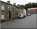

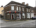
75 photos from this area
Area Information
Key information about the SA6 7DU including its size, population, and administrative classification.
- Area Type
- Postcode
- Area Size
- 2.0 hectares
- Population
- 1566
- Population Density
- 3086 people/km²
House Prices in SA6 7DU
42
Properties
£126,552
Average Sold Price
£500
Lowest Price
£225,000
Highest Price
Showing 42 properties
| Address | Type | Beds | Baths | Last Sale Price | Last Sale Date | |
|---|---|---|---|---|---|---|
| 37 Tan Y Lan Terrace, Morriston, Swansea, SA6 7DU | Semi-detached | 3 | 1 | £218,000 | Oct 2025 | |
| 73 Tan Y Lan Terrace, Morriston, Swansea, SA6 7DU | Semi-detached | 3 | 1 | £225,000 | Sep 2023 | |
| 67 Tan Y Lan Terrace, Morriston, Swansea, SA6 7DU | Semi-detached | - | - | £500 | Jun 2022 | |
| 65 Tanylan Terrace, Morriston, Swansea, SA6 7DU | Semi-detached | 2 | 1 | £168,000 | May 2022 | |
| 71 Tan Y Lan Terrace, Morriston, Swansea, SA6 7DU | house | - | - | £149,995 | Feb 2022 | |
| 53 Tan Y Lan Terrace, Morriston, Swansea, SA6 7DU | Detached | 2 | 1 | £90,000 | Jul 2020 | |
| 8 Tan Y Lan Terrace, Morriston, Swansea, SA6 7DU | Semi-detached | - | - | £150,000 | Jan 2020 | |
| 45 Tan Y Lan Terrace, Morriston, Swansea, SA6 7DU | Semi-detached | 4 | 2 | £180,000 | Apr 2019 | |
| 39 Tan Y Lan Terrace, Morriston, Swansea, SA6 7DU | Detached | 3 | 1 | £125,000 | May 2017 | |
| 76 Tan Y Lan Terrace, Morriston, Swansea, SA6 7DU | Semi-detached | 2 | 1 | £90,000 | Jul 2015 |
Page 1 of 5
Energy Efficiency in SA6 7DU
Amenities
Schools
| Rank | School | Type | Entry gender | Ages |
|---|
Explore more schools in this area
Go to Schools tabDemographics
Household Size
Two person
most common
Accommodation Type
Houses
most common
Tenure
81
majority
Ethnic Group
White
most common
Religion
N/A
most common
Household Composition
N/A
most common
Age
47
median
Adults (30-64 years)
most common
Household Deprivation
N/A
with no deprivation
NS-SEC
30
in Lower managerial occupations
Explore more demographic insights in this area
Go to Demographics tabPlanning
Planning Constraints
- Flood RiskPremium
- Ramsar Wetland SitesPremium
- Area of Outstanding Natural BeautyPremium
- Protected Nature ReservePremium
- Protected WoodlandPremium
- Crime RiskPremium