Area Overview for SA6 5NT
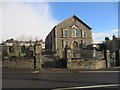
Photos of SA6 5NT


Area Information
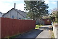
Living in SA6 5NT offers a quiet residential experience within a specific cluster of homes. This postcode area covers a small residential cluster in Wales with a total population of 1,396. You will find a community density of 332 people per square kilometre, creating an intimate neighbourhood feel. The location is situated in South Wales, distinct from the English border counties, and offers a suburban backdrop typical of the region. Daily life here revolves around local interaction and proximity to key transport links. The area is characterised by its manageable size, allowing residents to know their neighbours quickly. It serves as a stable community base with low transient populations. Prospective buyers looking for a settled environment will appreciate the defined boundaries and focused nature of this cluster. You are entering a space designed primarily for housing rather than commercial activity. The surrounding landscape supports a pace of life that balances comfort with accessibility to near-by services.
- Area Type
- Postcode
- Area Size
- Not available
- Population
- 1396
- Population Density
- 332 people/km²
Homes in SA6 5NT are predominantly houses, forming the backbone of the local housing stock. The accommodation type data confirms a focus on detached or semi-detached living rather than flats or apartments. With 86% home ownership, this area functions as a primary market for owners rather than a rental hub. You are likely to find buyers seeking permanent residences within Samian's immediate surroundings. The low population of 1,396 means property supply is limited compared to larger urban centres. This scarcity can make specific properties highly prized within the cluster. The high ownership percentage directly impacts the market dynamic, reducing the number of privately rented options available. Families looking to buy will find a environment aligned with their desire for space and stability. Rental competition is lower due to the heavy owner-occupier presence. Buyers should expect a market driven by exchange rather than letting agreements.
House Prices in SA6 5NT
No properties found in this postcode.
Energy Efficiency in SA6 5NT
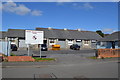
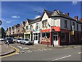
Residents of SA6 5NT enjoy practical access to retail and transport hubs within practical reach. You can visit Co-op Clydach or Co-op USSF for daily shopping needs without travelling far. Tesco Swansea lies slightly further away but remains a notable retail option for larger purchases. Transport links include Llansamlet Railway Station, Skewen Railway Station, and Neath Railway Station, giving you five nearby rail access points. These stations connect you to wider Welsh networks efficiently. Swansea Queens Dock Ferry Terminal is also one point away, offering ferry crossings for those needing to travel the coast. The presence of five retail and five rail options ensures convenience without crowding. You do not need to rely solely on a private car for general commuting or shopping trips. The variety of stations means one faulty line rarely halts your entire journey. Nearby amenities provide a self-sufficient lifestyle for families in this postcode area.
Amenities
Schools
Families living in SA6 5NT have St Joseph's Catholic Primary School as a nearest educational facility. This primary institution serves the early schooling needs of local residents. The data lists the school type as "other", indicating a specific religious or community affiliation within the South Wales system. There is no secondary school listed in the immediate proximity data. This setup means older children in your household will likely travel to schools outside the SA6 5NT immediate radius. You must consider the commute time for teenagers when viewing properties here. St Joseph's Catholic Primary School is the only specific name available for educational provision. The single-option school list highlights a focused local facility rather than diverse academic choices within walking distance. Parents needs to investigate catchment areas and bus routes for secondary education carefully. The data does not provide Ofsted ratings or specific capacity figures for these institutions.
| Rank | School | Type | Entry gender | Ages |
|---|
Explore more schools in this area
Go to Schools tabDemographics
The community in SA6 5NT reflects a mature demographic profile. The median age is 47 years, indicating a population dominated by established households. Over 86% of residents report owning their homes, which creates a stable and settled environment. This high ownership rate suggests long-term residents rather than transient tenants. The most common age range comprises adults between 30 and 64 years, meaning the area suits families and professionals in their prime earning years. The predominant ethnic group is White, representing the majority of the local population. You will encounter a homogenous community structure where generations often stay local. The high home ownership figure reinforces the idea that this is a place for people who have put down roots. Demographic data confirms a lack of significant youth bulge, suggesting schools must cater to families with older children. The area appeals to those seeking a quiet adult lifestyle over a high-energy student setting.
Household Size
Accommodation Type
Tenure
Ethnic Group
Religion
Household Composition
Age
Household Deprivation
NS-SEC
Explore more demographic insights in this area
Go to Demographics tabPlanning
Planning Constraints
- Flood RiskPremium
- Ramsar Wetland SitesPremium
- Area of Outstanding Natural BeautyPremium
- Protected Nature ReservePremium
- Protected WoodlandPremium
- Crime RiskPremium