Area Overview for SA5 8AP
Photos of SA5 8AP
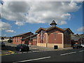
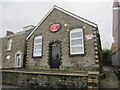
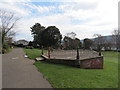
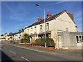
6 photos from this area
Area Information
Key information about the SA5 8AP including its size, population, and administrative classification.
- Area Type
- Postcode
- Area Size
- 9954 m²
- Population
- 1427
- Population Density
- 3909 people/km²
House Prices in SA5 8AP
20
Properties
£71,125
Average Sold Price
£24,000
Lowest Price
£110,000
Highest Price
Showing 20 properties
| Address | Type | Beds | Baths | Last Sale Price | Last Sale Date | |
|---|---|---|---|---|---|---|
| 6 Maesglas Road, Gendros, Swansea, SA5 8AP | Bungalow | - | - | £110,000 | Sep 2023 | |
| 2 Maesglas Road, Gendros, Swansea, SA5 8AP | Bungalow | - | - | £75,000 | Jul 2021 | |
| 14 Maesglas Road, Gendros, Swansea, SA5 8AP | Bungalow | - | - | £75,500 | Jun 2007 | |
| 30 Maesglas Road, Gendros, Swansea, SA5 8AP | Flat | 2 | 1 | £24,000 | Jun 2005 | |
| 32 Maesglas Road, Gendros, Swansea, SA5 8AP | Flat | - | - | - | - | |
| 18 Maesglas Road, Gendros, Swansea, SA5 8AP | Bungalow | - | - | - | - | |
| 38 Maesglas Road, Gendros, Swansea, SA5 8AP | Flat | - | - | - | - | |
| 10 Maesglas Road, Gendros, Swansea, SA5 8AP | Semi-detached | - | - | - | - | |
| 4 Maesglas Road, Gendros, Swansea, SA5 8AP | Bungalow | - | - | - | - | |
| 16 Maesglas Road, Gendros, Swansea, SA5 8AP | Bungalow | - | - | - | - |
Page 1 of 2
Energy Efficiency in SA5 8AP
Amenities
Schools
| Rank | School | Type | Entry gender | Ages |
|---|
Explore more schools in this area
Go to Schools tabDemographics
Household Size
One person
most common
Accommodation Type
Houses
most common
Tenure
55
majority
Ethnic Group
White
most common
Religion
N/A
most common
Household Composition
N/A
most common
Age
47
median
Adults (30-64 years)
most common
Household Deprivation
N/A
with no deprivation
NS-SEC
17
in Lower managerial occupations
Explore more demographic insights in this area
Go to Demographics tabPlanning
Planning Constraints
- Flood RiskPremium
- Ramsar Wetland SitesPremium
- Area of Outstanding Natural BeautyPremium
- Protected Nature ReservePremium
- Protected WoodlandPremium
- Crime RiskPremium