Area Overview for SA5 7LN
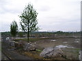
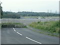
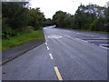
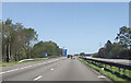
Photos of SA5 7LN


Area Information
Living in SA5 7LN means residing within a specific residential cluster defined by postcode SA5 7LN. This area spans 28.9 hectares and hosts a population of 1,862 people. The location offers a lived-in community feel rather than a sprawling urban district. Residents experience a quiet environment where neighbours often know each other by name. The housing stock is concentrated in a small footprint, creating a neighbourhood with a strong local identity. You will find this area sits comfortably within the broader Swansea context while maintaining its own distinct character. Daily life revolves around convenience, with essential services nearby. The low population density compared to larger cities allows for a relaxed pace of living. Homes here are predominantly detached or semi-detached rather than high-rise apartments. You are part of a settled community where long-term residents remain. The postcode represents a practical choice for those seeking stability over rapid development. Your view is likely to be of gardens or other houses rather than busy main roads. This area combines the benefits of a definable home zone with access to wider transport hubs. It is a place where the pace of life matches the size of the neighbourhood.
- Area Type
- Postcode
- Area Size
- 28.9 hectares
- Population
- 1862
- Population Density
- 158 people/km²
The property market in SA5 7LN is firmly established as an owner-occupied district. An impressive 82% of homes are owned by their occupants, meaning the local estate is defined by long-term residents rather than transient tenants. Houses make up the primary accommodation type, offering standalone or semi-detached living rather than flats or apartments. This housing stock appeals to families and individuals seeking stability and Private Gardens. The low proportion of buy-to-let properties means landlords are less influential in shaping the neighbourhood's character. When you search for homes in SA5 7LN, you will find properties suited for people who plan to stay. The area does not suffer from the churn typical of student or tourist rental zones. Prices may reflect this stability due to the strong sense of belonging within the estate. Buyers looking for a permanent home will find this postcode highly compatible with their needs. The small area size of 28.9 hectares limits the total number of properties available. Such scarcity can sustain value but also restricts immediate supply. Houses retain their status as the default choice for most transactions here.
House Prices in SA5 7LN
No properties found in this postcode.
Energy Efficiency in SA5 7LN
Life in SA5 7LN benefits from immediate access to practical amenities within easy reach. Retail options include a Spar, a Co-op USSF, and the Heron Morriston supermarket, offering comprehensive grocery shopping. Travelers can utilize several railway stations nearby, including Llansamlet, Swansea, and Gowerton Railway Stations. These hubs provide efficient rail connections to major cities and coastal towns. For maritime travel, you are one stop away from the Swansea Queens Dock Ferry Terminal. This convenience allows for quick trips to Ireland and other ports without long distances. Your daily routine involves stopping at these well-known shops for essentials or catching a train to the city centre. The presence of diverse transport options ensures you can commute flexibly. Nearby leisure facilities and parks might be a short walk down the road. You do not need a car for basic errands or local trips. The amenities listed create a self-contained lifestyle where most needs are met locally. Shopping, dining, and travel are all integrated into the immediate surroundings. This layout saves time and reduces reliance on major motorways for routine tasks.
Amenities
Schools
| Rank | School | Type | Entry gender | Ages |
|---|
Explore more schools in this area
Go to Schools tabDemographics
The community profile in SA5 7LN reflects a mature and stable population. The median age stands at 47 years, indicating that adults aged between 30 and 64 years form the most common age range. This demographic suggests a neighbourhood dominated by working families and established professionals. You are likely to meet neighbours who have been living in the area for many years. The area exhibits a high level of home ownership, with 82% of residents owning their property outright. This figure signals a settled market where investment in homes is the norm. There are very few private rentals compared to owner-occupied households. The predominant ethnic group is White, which aligns with the broader cultural makeup of the region. Most accommodation types consist of houses, reinforcing the family-oriented nature of the streets. This demographic stability supports local schools and community groups. The average resident has completed a significant portion of their working life. Children remain in the area as they grow older rather than moving away. This creates continuity that benefits anyone considering moving into the postcode. The population density reaches 158 people per square kilometre, ensuring you stay close to services without overwhelming traffic.
Household Size
Accommodation Type
Tenure
Ethnic Group
Religion
Household Composition
Age
Household Deprivation
NS-SEC
Explore more demographic insights in this area
Go to Demographics tabPlanning
Planning Constraints
- Flood RiskPremium
- Ramsar Wetland SitesPremium
- Area of Outstanding Natural BeautyPremium
- Protected Nature ReservePremium
- Protected WoodlandPremium
- Crime RiskPremium