Area Overview for SA5 5DP
Photos of SA5 5DP
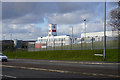
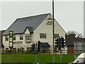
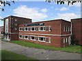

15 photos from this area
Area Information
Key information about the SA5 5DP including its size, population, and administrative classification.
- Area Type
- Postcode
- Area Size
- 4102 m²
- Population
- 1559
- Population Density
- 2958 people/km²
House Prices in SA5 5DP
18
Properties
£76,973
Average Sold Price
£29,000
Lowest Price
£142,600
Highest Price
Showing 18 properties
| Address | Type | Beds | Baths | Last Sale Price | Last Sale Date | |
|---|---|---|---|---|---|---|
| 11 Lancaster Court, Ravenhill, Swansea, SA5 5DP | Terraced | 2 | 1 | £127,000 | Feb 2025 | |
| 12 Lancaster Court, Ravenhill, Swansea, SA5 5DP | Terraced | 3 | - | £142,600 | Nov 2024 | |
| 17 Lancaster Court, Ravenhill, Swansea, SA5 5DP | house | 2 | - | £80,000 | Apr 2019 | |
| 16 Lancaster Court, Ravenhill, Swansea, SA5 5DP | house | 2 | - | £85,500 | Apr 2019 | |
| 9 Lancaster Court, Ravenhill, Swansea, SA5 5DP | Terraced | 2 | 1 | £70,000 | May 2018 | |
| 18 Lancaster Court, Ravenhill, Swansea, SA5 5DP | Terraced | 3 | 1 | £84,065 | Mar 2018 | |
| 3 Lancaster Court, Ravenhill, Swansea, SA5 5DP | Terraced | 2 | 1 | £75,000 | Dec 2016 | |
| 10 Lancaster Court, Ravenhill, Swansea, SA5 5DP | Terraced | 2 | 1 | £58,000 | Oct 2013 | |
| 7 Lancaster Court, Ravenhill, Swansea, SA5 5DP | Terraced | - | - | £93,500 | Jul 2008 | |
| 4 Lancaster Court, Ravenhill, Swansea, SA5 5DP | Terraced | - | - | £75,000 | Apr 2005 |
Page 1 of 2
Energy Efficiency in SA5 5DP
Amenities
Schools
| Rank | School | Type | Entry gender | Ages |
|---|
Explore more schools in this area
Go to Schools tabDemographics
Household Size
Family (3-5 people)
most common
Accommodation Type
Houses
most common
Tenure
68
majority
Ethnic Group
White
most common
Religion
N/A
most common
Household Composition
N/A
most common
Age
47
median
Adults (30-64 years)
most common
Household Deprivation
N/A
with no deprivation
NS-SEC
25
in Lower managerial occupations
Explore more demographic insights in this area
Go to Demographics tabPlanning
Planning Constraints
- Flood RiskPremium
- Ramsar Wetland SitesPremium
- Area of Outstanding Natural BeautyPremium
- Protected Nature ReservePremium
- Protected WoodlandPremium
- Crime RiskPremium