Area Overview for SA5 4SJ
Photos of SA5 4SJ
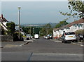
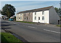
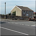
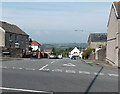
29 photos from this area
Area Information
Key information about the SA5 4SJ including its size, population, and administrative classification.
- Area Type
- Postcode
- Area Size
- 1.7 hectares
- Population
- 1533
- Population Density
- 1411 people/km²
House Prices in SA5 4SJ
14
Properties
£197,150
Average Sold Price
£18,750
Lowest Price
£425,000
Highest Price
Showing 14 properties
| Address | Type | Beds | Baths | Last Sale Price | Last Sale Date | |
|---|---|---|---|---|---|---|
| 1 Westfield Road, Waunarlwydd, Swansea, SA5 4SJ | Detached | 4 | 1 | £255,000 | Aug 2024 | |
| 30 Westfield Road, Waunarlwydd, Swansea, SA5 4SJ | Detached | 4 | 3 | £425,000 | Mar 2024 | |
| 26 Westfield Road, Waunarlwydd, Swansea, SA5 4SJ | house | - | - | £195,000 | Sep 2022 | |
| 4 Westfield Road, Waunarlwydd, Swansea, SA5 4SJ | Detached | 4 | - | £370,000 | Jan 2022 | |
| 22 Westfield Road, Waunarlwydd, Swansea, SA5 4SJ | Detached | 5 | 3 | £18,750 | Apr 2021 | |
| 24 Westfield Road, Waunarlwydd, Swansea, SA5 4SJ | Detached | 5 | 3 | £75,000 | Feb 2021 | |
| 2 Westfield Road, Waunarlwydd, Swansea, SA5 4SJ | Land | 4 | - | £200,000 | Oct 2005 | |
| 19 Westfield Road, Waunarlwydd, Swansea, SA5 4SJ | Detached | - | - | £50,000 | Nov 2004 | |
| The Mews, Westfield Road, Waunarlwydd, Swansea, SA5 4SJ | house | - | - | £185,600 | Oct 2002 | |
| The Lodge, Westfield Road, Waunarlwydd, Swansea, SA5 4SJ | Detached | 5 | 2 | - | - |
Page 1 of 2
Energy Efficiency in SA5 4SJ
Amenities
Schools
| Rank | School | Type | Entry gender | Ages |
|---|
Explore more schools in this area
Go to Schools tabDemographics
Household Size
Two person
most common
Accommodation Type
Houses
most common
Tenure
88
majority
Ethnic Group
White
most common
Religion
N/A
most common
Household Composition
N/A
most common
Age
47
median
Adults (30-64 years)
most common
Household Deprivation
N/A
with no deprivation
NS-SEC
33
in Lower managerial occupations
Explore more demographic insights in this area
Go to Demographics tabPlanning
Planning Constraints
- Flood RiskPremium
- Ramsar Wetland SitesPremium
- Area of Outstanding Natural BeautyPremium
- Protected Nature ReservePremium
- Protected WoodlandPremium
- Crime RiskPremium