Area Overview for SA5 4EA
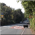
Photos of SA5 4EA


Area Information
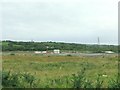
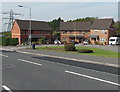
Living in SA5 4EA means residing in a specific postcode area covering a small residential cluster within Wales. With a population of 1,434, this location offers a contained community feel rather than the density of a major urban centre. The area sits at a population density of 1,422 people per square kilometre, indicating a tightly packed yet distinctly local environment. You will find that daily life here is defined by its residential nature, characterised by houses rather than high-rise flats. This setting provides a quiet base for those wishing to settle in South Wales without the overwhelming scale of the wider Swansea conurbation. The neighbourhood is populated by adults aged between 30 and 64 years, suggesting stability and long-term residents who have established roots in the valley. For anyone considering homes in SA5 4EA, the geography supports a pace of life that values proximity to friends and family over constant access to city centre nightlife. It is a place where the boundaries of your immediate surroundings are clearly defined, offering a sense of ownership over a specific patch of Welsh countryside. The district functions as a standalone community unit, separate from the broader administrative divisions that cover the wider Swansea region.
- Area Type
- Postcode
- Area Size
- Not available
- Population
- 1434
- Population Density
- 1422 people/km²
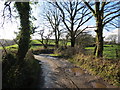
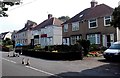
The property market in SA5 4EA is characterised by a predominantly owner-occupied stock. With 67 per cent of residents owning their homes, this figure distinguishes the postcode from many rental-heavy urban areas. The accommodation type is overwhelmingly houses, meaning buyers can expect to find detached or semi-detached properties rather than rows of flats or terraced mews units. This housing mix suits families and individuals seeking space and privacy. When looking at homes in SA5 4EA, you will find that the market is driven by people who have stayed in the area for decades. This long-term tenure often results in well-maintained properties and established gardens that define the local character. The small scale of the postcode area, holding just 1,434 people, means that no two streets look exactly the same. There is little variation in property age or style because the cluster is tightly bound geographically. For investors or first-time buyers, this environment offers a predictable market where values are influenced by local family needs rather than short-term let demand. The high ownership rate suggests that those buying here are typically looking to build equity and settle down.
House Prices in SA5 4EA
No properties found in this postcode.
Energy Efficiency in SA5 4EA
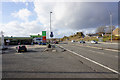
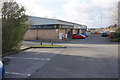
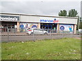
Your everyday convenience living in SA5 4EA is supported by a network of amenities within practical reach. For your grocery shopping needs, three major supermarkets are available in the surrounding radius. You can visit Aldi Pontardulais, Tesco Swansea, and Lidl Penlan to satisfy your weekly food requirements. These retailers are all within a reasonable travel distance, ensuring you do not need to travel far for dietary staples. Transport links connect you to the wider region through five nearby railway stations. Choices include Swansea Railway Station, Gowerton Railway Station, and Llansamlet Railway Station. If travel by rail is essential for your work or leisure plans, you have three distinct departure points nearby. For those who require air travel, two airports are listed in the vicinity, both identified as Swansea Airport, providing national and international connectivity. If you require ferry transport, the Swansea Queens Dock Ferry Terminal is also within practical reach. This variety of transport options means you are never locked out of the rest of the UK by your postcode location. The availability of these specific venues ensures a high standard of access to essential services.
Amenities
Schools
Families living in SA5 4EA have access to a limited selection of educational institutions in their immediate vicinity. The nearest school listed for this postcode is Maes Derw. This institution is classified as an 'other' type school, which is a specific category distinct from the primary and secondary divisions seen in larger districts. There are no comprehensive schools, infant schools, or secondary schools explicitly named within the provided data for this specific cluster. This scarcity of named institutions suggests that residents may rely on transport links to reach larger hubs for their children's primary or secondary education, or that Maes Derw serves a specific niche within the local education landscape. You should verify the precise age range and curriculum of Maes Derw with the local council to ensure it meets your family's specific needs. While the data points to only one school designation, the practical reality often involves cross-boundary commuting. Parents in this area may look towards Swansea for a wider range of rated institutions given the concentration of homes in SA5 4EA and its proximity to the wider city. The limited local school data reflects the small residential cluster nature of the postcode.
| Rank | School | Type | Entry gender | Ages |
|---|
Explore more schools in this area
Go to Schools tabDemographics
The community in SA5 4EA is dominated by adults aged 30 to 64 years, with a median age of 47. This age profile suggests a neighbourhood populated by families in the middle stages of their lives and established residents who are less likely to move frequently. A significant majority of households own their property, with home ownership levels reaching 67%. This high rate indicates that the area is primarily an owner-occupied zone rather than a transient rental market. Residents tend to stay put, fostering stable neighbourhood relationships over the years. The predominant ethnic group is White, reflecting the traditional demographic composition of this part of Wales. Most accommodation within this cluster consists of houses, which aligns with the family-oriented age profile. You are unlikely to find social housing or purpose-built rental blocks dominating the streetscape. The demographic data reflects a settled population where people have invested time and money into their homes. This stability often translates to quieter streets and a predictable community atmosphere.
Household Size
Accommodation Type
Tenure
Ethnic Group
Religion
Household Composition
Age
Household Deprivation
NS-SEC
Explore more demographic insights in this area
Go to Demographics tabPlanning
Planning Constraints
- Flood RiskPremium
- Ramsar Wetland SitesPremium
- Area of Outstanding Natural BeautyPremium
- Protected Nature ReservePremium
- Protected WoodlandPremium
- Crime RiskPremium